
Magnitude |
3.7 |
| Date & Time (UTC) | 2010-01-02 22:13:11.0 |
| Date & Time (Local) | 1388/10/13 01:43:11.0 |
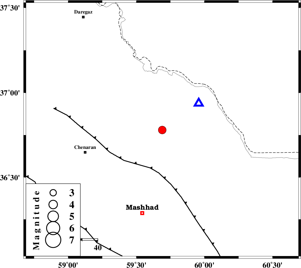
| Location | Lat:36.78 Lon: 59.69 |
| Region | 52 km North-East of Chenaran, Khorasan(center) Province |
Nearest Cities |
|
| 14 km North of Kardehno, Khorasan(center) Province | |
| 24 km South West of Kalat, Khorasan(center) Province | |
| 28 km North East of Govarashk, Khorasan(center) Province | |
| 34 km North of Faz, Khorasan(center) Province | |
| 41 km North East of Mohsenabad, Khorasan(center) Province | |
| Depth | 34 km |
| Agency | |
Faults within 150 km: |
|
| BINALUD_F1 (Length: 178 km) , Distance to epicenter: 26 km | |
| BINALUD_F1 (Length: 129 km) , Distance to epicenter: 82 km | |
| NAYSHABUR_F (Length: 74 km) , Distance to epicenter: 97 km | |
| Number of Phases | 5 |
| RMS | 0.5 |
| Number of Stations | 4 |
| Error in Latitude | >20 km |
| Error in Longitude | 33.8 km |
| Error in Depth | 22.6 km |
Download waveform in seisan format
to download seisan software Click here
to access information about IIEES stations Click here
Amplitude | ||||||||
| UID | Agency | Station | Component | Amplitude | Period | Arrival Time | Proccessing Time | Signal Clip |
| 53482 | IIEES | BJRD | N | 694.9 | 1.33 | 2010-01-02 22:14:21 | 2010-01-02 10:46:00 | n |
| 53483 | IIEES | BJRD | E | 1061.7 | 1.33 | 2010-01-02 22:14:24 | 2010-01-02 10:46:00 | n |
| 53484 | IIEES | MRVT | N | 171.8 | 0.68 | 2010-01-02 22:14:51 | 2010-01-02 10:46:00 | n |
| 53485 | IIEES | MRVT | E | 138.1 | 0.85 | 2010-01-02 22:14:52 | 2010-01-02 10:46:00 | n |
Phase | ||||||||||||
| Agency | Station | Component | Phase Type | Phase Quality | First Motion | Observed Arrival Time | Time Residual | Loc. Flag | Input Weight | Distance | Azimuth | |
| IIEES | BJRD | Z | Pg | E | 2010-01-02 22:13:47 | -0.27 | y | 226 | 298 | |||
| IIEES | BJRD | N | Sg | E | 2010-01-02 22:14:14 | 0.24 | y | 226 | 298 | |||
| IIEES | MRVT | Z | Pn | E | 2010-01-02 22:13:58 | 0.34 | y | 334 | 288 | |||
| IIEES | SHRD | Z | Pn | E | 2010-01-02 22:13:58 | -0.78 | y | 340 | 257 | |||
| IIEES | TABS | Z | Pn | E | 2010-01-02 22:14:09 | 0.46 | y | 418 | 215 | |||