
Magnitude |
2.8 |
| Date & Time (UTC) | 2010-01-10 08:28:00.3 |
| Date & Time (Local) | 1388/10/20 11:58:00.3 |
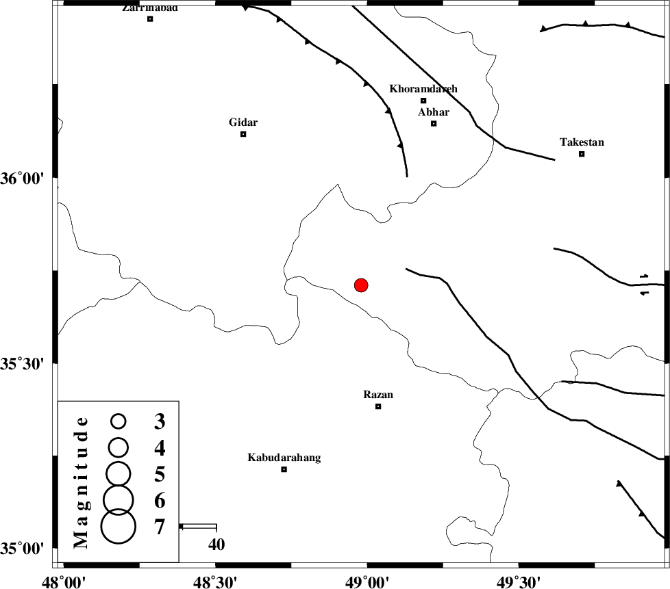
| Location | Lat:35.71 Lon: 48.98 |
| Region | 36 km North of Razan, Hamedan Province |
Nearest Cities |
|
| 27 km North West of Avaj, Ghazvin Province | |
| 27 km North East of Khorandeh, Hamedan Province | |
| 27 km North East of Kahla, Zanjan Province | |
| 28 km West of Ab-e garm, Ghazvin Province | |
| 33 km North East of Damag, Hamedan Province | |
| Depth | 15 km |
| Agency | |
Faults within 150 km: |
|
| KUSHK_E_NOSRAT_F (Length: 230 km) , Distance to epicenter: 14 km | |
| SOLTANIYEH_F (Length: 119 km) , Distance to epicenter: 35 km | |
| IPAK_F (Length: 80 km) , Distance to epicenter: 58 km | |
| Number of Phases | 7 |
| RMS | 0.2 |
| Number of Stations | 5 |
| Error in Latitude | >1.9 km |
| Error in Longitude | 3.2 km |
| Error in Depth | 7.4 km |
Download waveform in seisan format
to download seisan software Click here
to access information about IIEES stations Click here
Amplitude | ||||||||
| UID | Agency | Station | Component | Amplitude | Period | Arrival Time | Proccessing Time | Signal Clip |
| 53770 | IIEES | SNGE | N | 113.3 | 0.51 | 2010-01-10 08:28:47 | 2010-01-10 08:47:00 | n |
| 53771 | IIEES | DAMV | E | 61 | 0.6 | 2010-01-10 08:29:19 | 2010-01-10 08:47:00 | n |
| 53772 | IIEES | DAMV | N | 32.8 | 0.4 | 2010-01-10 08:29:20 | 2010-01-10 08:47:00 | n |
Phase | ||||||||||||
| Agency | Station | Component | Phase Type | Phase Quality | First Motion | Observed Arrival Time | Time Residual | Loc. Flag | Input Weight | Distance | Azimuth | |
| IIEES | ZNJK | Z | Pg | E | 2010-01-10 08:28:19 | 0.2 | y | 110 | 346 | |||
| IIEES | ZNJK | E | Sg | E | 2010-01-10 08:28:32 | 0 | y | 110 | 346 | |||
| IIEES | ASAO | Z | Pg | E | 2010-01-10 08:28:27 | 0.3 | y | 160 | 143 | |||
| IIEES | ASAO | E | Sg | E | 2010-01-10 08:28:46 | -0.1 | y | 160 | 143 | |||
| IIEES | SNGE | Z | Pg | E | 2010-01-10 08:28:27 | -0.2 | y | 163 | 246 | |||
| IIEES | CHTH | Z | Pg | E | 2010-01-10 08:28:32 | -0.3 | y | 195 | 83 | |||
| IIEES | DAMV | Z | Pn | E | 2010-01-10 08:28:41 | 0 | y | 271 | 91 | |||