
Magnitude |
2.5 |
| Date & Time (UTC) | 2009-08-04 16:38:35.7 |
| Date & Time (Local) | 1388/5/13 21:08:35.7 |
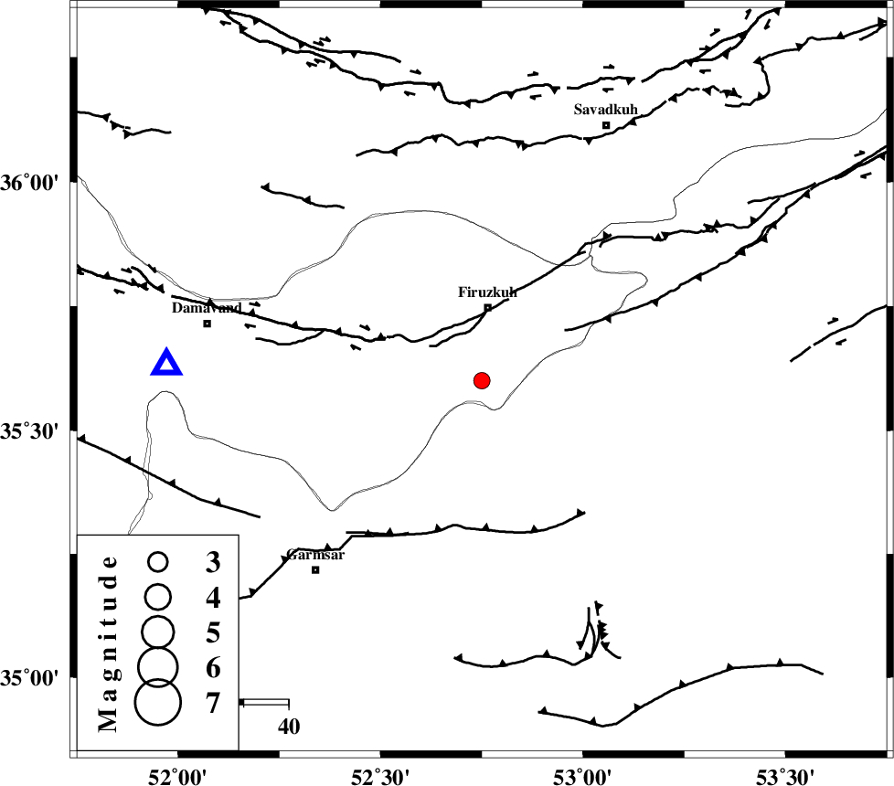
| Location | Lat:35.6 Lon: 52.75 |
| Region | Tehran Province, 16 km South of Firuzkuh |
Nearest Cities |
|
| 13 km North East of Atashan, Tehran Province | |
| 17 km South of Firuzkuh, Tehran Province | |
| 23 km South of Shahrabad, Tehran Province | |
| 30 km South East of Arjomand, Tehran Province | |
| 33 km North West of Aftar, Semnan Province | |
| Depth | 15 km |
| Agency | |
Faults within 150 km: |
|
| MOSHA_F (Length: 234 km) , Distance to epicenter: 14 km | |
| ATARI_F (Length: 185 km) , Distance to epicenter: 22 km | |
| GARMSAR_F (Length: 77 km) , Distance to epicenter: 38 km | |
| Number of Phases | 5 |
| RMS | 0.1 |
| Number of Stations | 4 |
| Error in Latitude | >3.1 km |
| Error in Longitude | 10.9 km |
| Error in Depth | 6.9 km |
Download waveform in seisan format
to download seisan software Click here
to access information about IIEES stations Click here
Amplitude | ||||||||
| UID | Agency | Station | Component | Amplitude | Period | Arrival Time | Proccessing Time | Signal Clip |
| 58083 | IIEES | DAMV | N | 268.9 | 0.73 | 2009-08-04 16:39:00 | 2009-10-27 01:19:00 | n |
| 58084 | IIEES | THKV | E | 56 | 0.14 | 2009-08-04 16:39:27 | 2009-10-27 01:19:00 | n |
| 58085 | IIEES | GHVR | E | 62.6 | 0.78 | 2009-08-04 16:39:32 | 2009-10-27 01:19:00 | n |
Phase | ||||||||||||
| Agency | Station | Component | Phase Type | Phase Quality | First Motion | Observed Arrival Time | Time Residual | Loc. Flag | Input Weight | Distance | Azimuth | |
| IIEES | DAMV | Z | Pg | E | 2009-08-04 16:38:48 | 0.2 | y | 70.2 | 273 | |||
| IIEES | THKV | Z | Pg | E | 2009-08-04 16:39:04 | -0.2 | y | 172 | 282 | |||
| IIEES | GHVR | Z | Pg | E | 2009-08-04 16:39:06 | 0 | y | 185 | 228 | |||
| IIEES | GHVR | N | Sg | E | 2009-08-04 16:39:28 | 0 | y | 185 | 228 | |||
| IIEES | ASAO | Z | Pn | E | 2009-08-04 16:39:17 | 0 | y | 274 | 246 | |||