
Magnitude |
3.7 |
| Date & Time (UTC) | 2009-09-24 18:01:10.0 |
| Date & Time (Local) | 1388/7/2 21:31:10.0 |
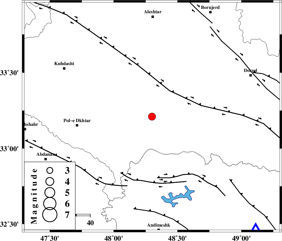
| Location | Lat:33.21 Lon: 48.3 |
| Region | Lorestan Province, 31 km South of Khorramabad |
Nearest Cities |
|
| 20 km South of Daraei, Lorestan Province | |
| 23 km South East of Shoorab-e sofla, Lorestan Province | |
| 27 km South of Badrabad-e sofla, Lorestan Province | |
| 30 km South West of Kamalvand-e gholamali, Lorestan Province | |
| 31 km South East of Godar-e mahmudvand, Lorestan Province | |
| Depth | 14 km |
| Agency | |
Faults within 150 km: |
|
| HZF4 (Length: 492 km) , Distance to epicenter: 23 km | |
| BALARUD_F_Z2 (Length: 58 km) , Distance to epicenter: 45 km | |
| BALARUD_F_Z3 (Length: 53 km) , Distance to epicenter: 47 km | |
| Number of Phases | 10 |
| RMS | 0.3 |
| Number of Stations | 7 |
| Error in Latitude | >6.9 km |
| Error in Longitude | 4.8 km |
| Error in Depth | 9.4 km |
Download waveform in seisan format
to download seisan software Click here
to access information about IIEES stations Click here
Amplitude | ||||||||
| UID | Agency | Station | Component | Amplitude | Period | Arrival Time | Proccessing Time | Signal Clip |
| 58622 | IIEES | ASAO | E | 631.4 | 0.44 | 2009-09-24 18:02:18 | 2009-10-25 09:10:00 | n |
| 58623 | IIEES | ASAO | N | 706.4 | 0.64 | 2009-09-24 18:02:23 | 2009-10-25 09:10:00 | n |
| 58624 | IIEES | GHVR | E | 240.5 | 0.56 | 2009-09-24 18:02:46 | 2009-10-25 09:10:00 | n |
| 58625 | IIEES | GHVR | N | 178.9 | 0.64 | 2009-09-24 18:02:52 | 2009-10-25 09:10:00 | n |
Phase | ||||||||||||
| Agency | Station | Component | Phase Type | Phase Quality | First Motion | Observed Arrival Time | Time Residual | Loc. Flag | Input Weight | Distance | Azimuth | |
| IIEES | KHMZ | Z | Pg | E | 2009-09-24 18:01:37 | -0.1 | y | 165 | 69 | |||
| IIEES | KHMZ | N | Sg | E | 2009-09-24 18:01:57 | -0.3 | y | 165 | 69 | |||
| IIEES | ASAO | Z | PN5 | E | 2009-09-24 18:01:44 | -0.3 | y | 217 | 47 | |||
| IIEES | ASAO | N | Sg | E | 2009-09-24 18:02:12 | 0.3 | y | 217 | 47 | |||
| IIEES | SNGE | Z | Pn | E | 2009-09-24 18:01:45 | -0.1 | y | 226 | 337 | |||
| IIEES | SNGE | N | Sg | E | 2009-09-24 18:02:14 | -0.2 | y | 226 | 337 | |||
| IIEES | GHVR | Z | Pn | E | 2009-09-24 18:01:57 | 1.7 | n | 4 | 306 | 62 | ||
| IIEES | THKV | Z | Pn | E | 2009-09-24 18:02:05 | 0.3 | y | 382 | 38 | |||
| IIEES | ZNJK | Z | Pn | E | 2009-09-24 18:02:06 | 0.4 | y | 385 | 5 | |||
| IIEES | NASN | Z | Pn | E | 2009-09-24 18:02:10 | 0.2 | y | 423 | 95 | |||