
Magnitude |
2 |
| Date & Time (UTC) | 2010-03-29 23:27:15.9 |
| Date & Time (Local) | 1389/1/10 03:57:15.9 |
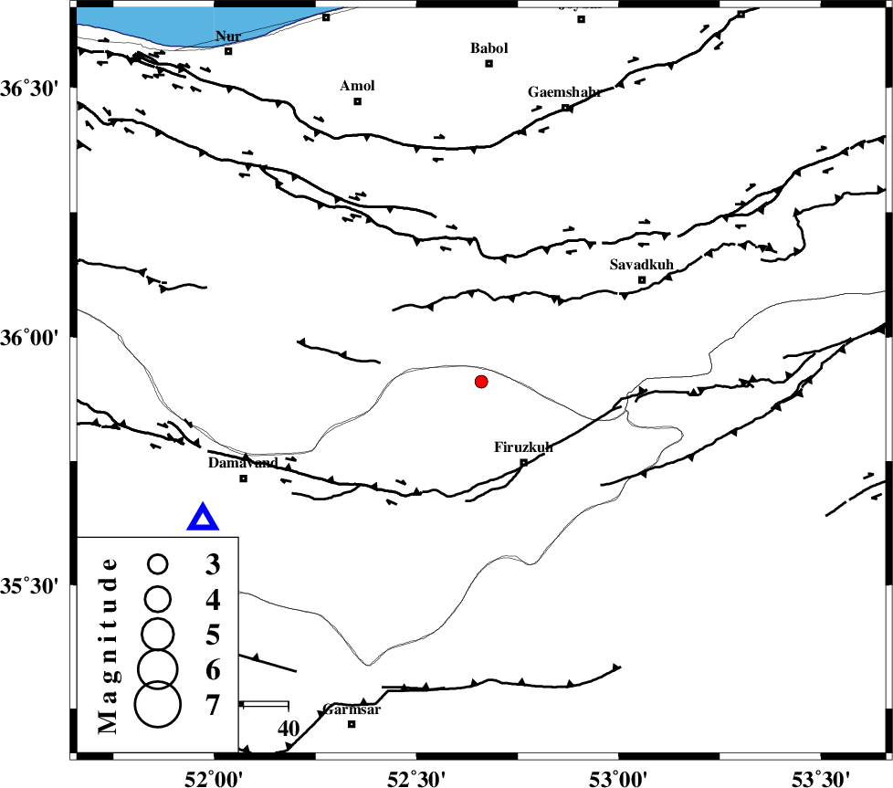
| Location | Lat:35.91 Lon: 52.66 |
| Region | Tehran Province, 20 km North-West of Firuzkuh |
Nearest Cities |
|
| 12 km North of Shahrabad, Tehran Province | |
| 17 km North East of Arjomand, Tehran Province | |
| 20 km North West of Firuzkuh, Tehran Province | |
| 23 km South West of Alasht, Mazandaran Province | |
| 31 km South of Firoozjah-e sabet, Mazandaran Province | |
| Depth | 27 km |
| Agency | |
Faults within 150 km: |
|
| MOSHA_F (Length: 234 km) , Distance to epicenter: 25 km | |
| N_ALBORZ_F (Length: 360 km) , Distance to epicenter: 29 km | |
| ATARI_F (Length: 185 km) , Distance to epicenter: 36 km | |
| Number of Phases | 5 |
| RMS | 0 |
| Number of Stations | 4 |
| Error in Latitude | >3.8 km |
| Error in Longitude | 4.9 km |
| Error in Depth | 3.4 km |
Download waveform in seisan format
to download seisan software Click here
to access information about IIEES stations Click here
Amplitude | ||||||||
| UID | Agency | Station | Component | Amplitude | Period | Arrival Time | Proccessing Time | Signal Clip |
| 58790 | IIEES | GHVR | E | 20.7 | 0.36 | 2010-03-29 23:28:22 | 2010-03-29 11:49:00 | n |
| 58791 | IIEES | GHVR | N | 13.8 | 0.6 | 2010-03-29 23:28:22 | 2010-03-29 11:49:00 | n |
| 58792 | IIEES | ASAO | E | 5 | 0.52 | 2010-03-29 23:28:37 | 2010-03-29 11:49:00 | n |
| 58793 | IIEES | ASAO | N | 3.9 | 0.64 | 2010-03-29 23:28:40 | 2010-03-29 11:49:00 | n |
Phase | ||||||||||||
| Agency | Station | Component | Phase Type | Phase Quality | First Motion | Observed Arrival Time | Time Residual | Loc. Flag | Input Weight | Distance | Azimuth | |
| IIEES | DAMV | Z | Pg | E | 2010-03-29 23:27:28 | 0 | y | 69.5 | 244 | |||
| IIEES | DAMV | N | Sg | E | 2010-03-29 23:27:37 | -0.1 | y | 69.5 | 244 | |||
| IIEES | CHTH | Z | Pn | E | 2010-03-29 23:27:39 | 0 | y | 138 | 270 | |||
| IIEES | GHVR | Z | Pn | E | 2010-03-29 23:27:47 | 0 | y | 204 | 220 | |||
| IIEES | ASAO | E | Sg | E | 2010-03-29 23:28:34 | 0 | y | 283 | 239 | |||