
Magnitude |
2.8 |
| Date & Time (UTC) | 2009-11-27 16:59:19.6 |
| Date & Time (Local) | 1388/9/6 20:29:19.6 |
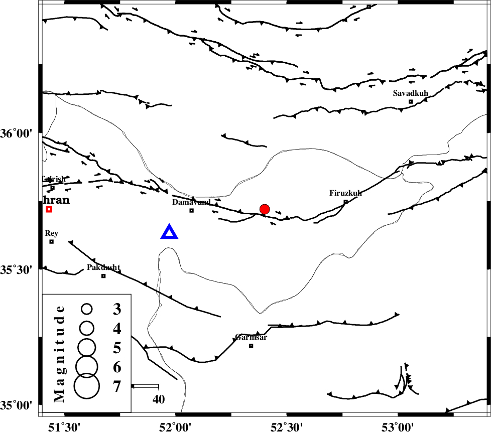
| Location | Lat:35.72 Lon: 52.4 |
| Region | Tehran Province, 30 km East of Damavand |
Nearest Cities |
|
| 12 km North of Sarbandan, Tehran Province | |
| 15 km West of Arjomand, Tehran Province | |
| 25 km North West of Atashan, Tehran Province | |
| 26 km North East of Mara, Tehran Province | |
| 27 km West of Shahrabad, Tehran Province | |
| Depth | 6 km |
| Agency | |
Faults within 150 km: |
|
| MOSHA_F (Length: 234 km) , Distance to epicenter: 5 km | |
| EYVANEKEY_F (Length: 74 km) , Distance to epicenter: 47 km | |
| GARMSAR_F (Length: 77 km) , Distance to epicenter: 48 km | |
| Number of Phases | 5 |
| RMS | 0.1 |
| Number of Stations | 4 |
| Error in Latitude | >4.7 km |
| Error in Longitude | 5.3 km |
| Error in Depth | 6 km |
Download waveform in seisan format
to download seisan software Click here
to access information about IIEES stations Click here
Amplitude | ||||||||
| UID | Agency | Station | Component | Amplitude | Period | Arrival Time | Proccessing Time | Signal Clip |
| 59311 | IIEES | DAMV | E | 1052.9 | 0.16 | 2009-11-27 16:59:33 | 2010-02-08 11:55:00 | n |
| 59312 | IIEES | DAMV | N | 1788.4 | 0.24 | 2009-11-27 16:59:33 | 2010-02-08 11:55:00 | n |
| 59313 | IIEES | GHVR | N | 80.6 | 0.28 | 2009-11-27 17:00:14 | 2010-02-08 11:55:00 | n |
| 59314 | IIEES | GHVR | E | 106.3 | 0.96 | 2009-11-27 17:00:15 | 2010-02-08 11:55:00 | n |
Phase | ||||||||||||
| Agency | Station | Component | Phase Type | Phase Quality | First Motion | Observed Arrival Time | Time Residual | Loc. Flag | Input Weight | Distance | Azimuth | |
| IIEES | DAMV | Z | Pg | E | 2009-11-27 16:59:27 | 0.2 | y | 40.5 | 256 | |||
| IIEES | DAMV | E | Sg | E | 2009-11-27 16:59:32 | 0 | y | 40.5 | 256 | |||
| IIEES | CHTH | Z | Pg | E | 2009-11-27 16:59:39 | -0.2 | y | 117 | 281 | |||
| IIEES | GHVR | Z | Pg | E | 2009-11-27 16:59:49 | -0.2 | y | 174 | 218 | |||
| IIEES | ASAO | Z | Pn | E | 2009-11-27 17:00:00 | 0.1 | y | 253 | 240 | |||