
Magnitude |
2.5 |
| Date & Time (UTC) | 2010-04-04 08:45:07.0 |
| Date & Time (Local) | 1389/1/15 13:15:07.0 |
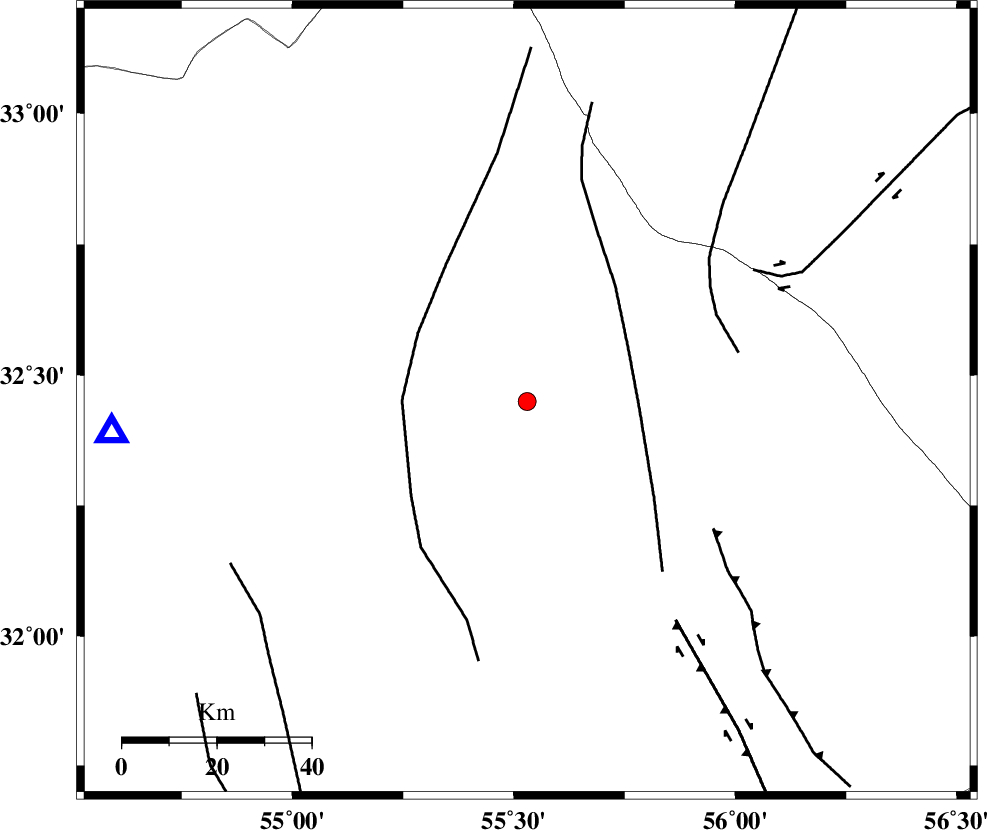
| Location | Lat:32.45 Lon: 55.53 |
| Region | Yazd Province, 95 km North-East of Bafq |
Nearest Cities |
|
| 63 km South of Robat-e posht-e badam, Yazd Province | |
| 80 km North West of Behabad, Yazd Province | |
| 82 km North East of Kharaneq, Yazd Province | |
| 83 km North West of Kushk, Yazd Province | |
| 88 km South East of Zarrin, Yazd Province | |
| Depth | 14 km |
| Agency | |
Faults within 150 km: |
|
| SARBALA_F (Length: 92 km) , Distance to epicenter: 24 km | |
| POSHT_E_BADAM_F (Length: 128 km) , Distance to epicenter: 26 km | |
| NAINI_F (Length: 342 km) , Distance to epicenter: 44 km | |
| Number of Phases | 5 |
| RMS | 0.1 |
| Number of Stations | 4 |
| Error in Latitude | >3.4 km |
| Error in Longitude | 1.5 km |
| Error in Depth | 5.3 km |
Download waveform in seisan format
to download seisan software Click here
to access information about IIEES stations Click here
Amplitude | ||||||||
| UID | Agency | Station | Component | Amplitude | Period | Arrival Time | Proccessing Time | Signal Clip |
| 59890 | IIEES | NASN | E | 19.5 | 0.44 | 2010-04-04 08:46:23 | 2010-04-04 09:07:00 | n |
| 59891 | IIEES | KRBR | N | 31.1 | 0.52 | 2010-04-04 08:46:34 | 2010-04-04 09:07:00 | n |
Phase | ||||||||||||
| Agency | Station | Component | Phase Type | Phase Quality | First Motion | Observed Arrival Time | Time Residual | Loc. Flag | Input Weight | Distance | Azimuth | |
| IIEES | TABS | Z | Pg | E | 2010-04-04 08:45:39 | 0 | y | 199 | 48 | |||
| IIEES | NASN | Z | Pn | E | 2010-04-04 08:45:47 | 0.2 | y | 258 | 279 | |||
| IIEES | NASN | E | Sg | E | 2010-04-04 08:46:20 | -0.1 | y | 258 | 279 | |||
| IIEES | KRBR | Z | Pn | E | 2010-04-04 08:45:51 | -0.1 | y | 298 | 157 | |||
| IIEES | SHRT | Z | P | E | 2010-04-04 08:46:12 | 0 | y | 464 | 72 | |||