
Magnitude |
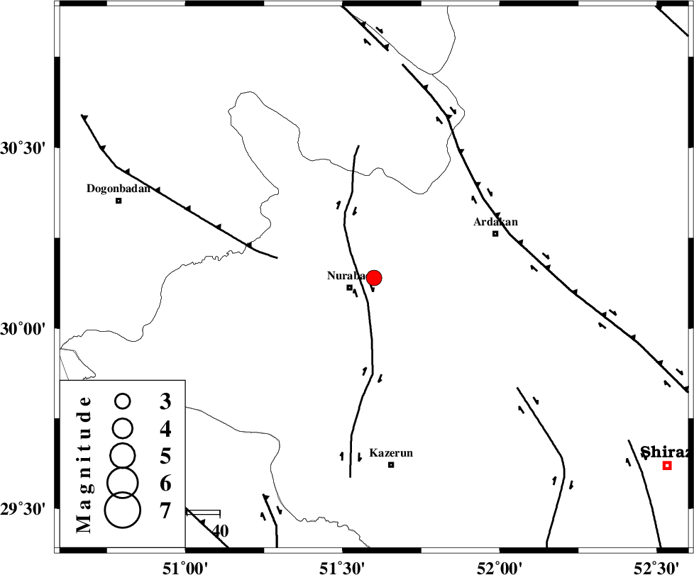
3.1 |
| Date & Time (UTC) | 2010-07-09 18:16:25.9 |
| Date & Time (Local) | 1389/4/18 22:46:25.9 |
| Location | Lat:30.14 Lon: 51.6 |
| Region | Fars Province, 8 km Nurabad |
Nearest Cities |
|
| 8 km North of Nurabad, Fars Province | |
| 9 km North of Gachgaran, Fars Province | |
| 14 km South of Masiri, Fars Province | |
| 14 km East of Fahlian-e olia, Fars Province | |
| 17 km North East of Ahangari, Fars Province | |
| Depth | 14 km |
| Agency | |
Faults within 150 km: |
|
| KAZERUN_F (Length: 96 km) , Distance to epicenter: 8 km | |
| MISHAN_F (Length: 76 km) , Distance to epicenter: 30 km | |
| HZF3 (Length: 197 km) , Distance to epicenter: 41 km | |
| Number of Phases | 5 |
| RMS | 0.2 |
| Number of Stations | 4 |
| Error in Latitude | >6.5 km |
| Error in Longitude | 7.8 km |
| Error in Depth | 12.4 km |
Download waveform in seisan format
to download seisan software Click here
to access information about IIEES stations Click here
Amplitude | ||||||||
| UID | Agency | Station | Component | Amplitude | Period | Arrival Time | Proccessing Time | Signal Clip |
| 65889 | IIEES | GHIR | N | 65.3 | 0.6 | 2010-07-09 18:17:46 | 2010-07-14 10:36:00 | n |
| 65890 | IIEES | GHIR | E | 125.7 | 0.6 | 2010-07-09 18:17:57 | 2010-07-14 10:36:00 | n |
| 65891 | IIEES | SNGE | N | 7.9 | 0.52 | 2010-07-09 18:19:14 | 2010-07-14 10:36:00 | n |
| 65892 | IIEES | SNGE | E | 7.6 | 0.56 | 2010-07-09 18:19:15 | 2010-07-14 10:36:00 | n |
Phase | ||||||||||||
| Agency | Station | Component | Phase Type | Phase Quality | First Motion | Observed Arrival Time | Time Residual | Loc. Flag | Input Weight | Distance | Azimuth | |
| IIEES | AHRM | Z | Pg | E | 2010-07-09 18:16:49 | 0 | y | 145 | 192 | |||
| IIEES | GHIR | Z | PN5 | E | 2010-07-09 18:17:04 | 0.2 | y | 246 | 146 | |||
| IIEES | GHIR | N | Sg | E | 2010-07-09 18:17:35 | -0.1 | y | 246 | 146 | |||
| IIEES | KHMZ | Z | Pn | E | 2010-07-09 18:17:27 | 0.2 | y | 428 | 339 | |||
| IIEES | SNGE | Z | Pn | E | 2010-07-09 18:17:57 | -0.4 | y | 679 | 325 | |||