
Magnitude |
3.9 |
| Date & Time (UTC) | 2010-07-20 20:01:28.4 |
| Date & Time (Local) | 1389/4/30 00:31:28.4 |
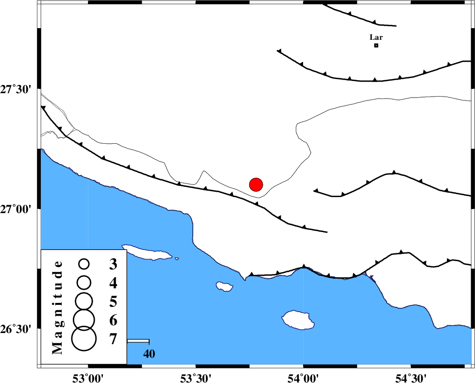
| Location | Lat:27.1 Lon: 53.78 |
| Region | Fars Province, 59 km West of Bastak |
Nearest Cities |
|
| 9 km of Ahl, Fars Province | |
| 21 km South East of Ashkenan, Fars Province | |
| 45 km South East of Beyram, Fars Province | |
| 51 km North West of Jenah, Hormozgan Province | |
| 51 km South West of Bagh, Fars Province | |
| Depth | 39 km |
| Agency | |
Faults within 150 km: |
|
| MFF3 (Length: 292 km) , Distance to epicenter: 9 km | |
| MFF1 (Length: 180 km) , Distance to epicenter: 27 km | |
| ZFF1 (Length: 165 km) , Distance to epicenter: 42 km | |
| Number of Phases | 5 |
| RMS | 0.1 |
| Number of Stations | 3 |
| Error in Latitude | >7.2 km |
| Error in Longitude | 3.6 km |
| Error in Depth | 4.6 km |
Download waveform in seisan format
to download seisan software Click here
to access information about IIEES stations Click here
Amplitude | ||||||||
| UID | Agency | Station | Component | Amplitude | Period | Arrival Time | Proccessing Time | Signal Clip |
| 66090 | IIEES | GHIR | N | 4508.8 | 0.72 | 2010-07-20 20:02:19 | 2010-07-20 08:54:00 | n |
| 66091 | IIEES | GHIR | E | 4855.2 | 0.6 | 2010-07-20 20:02:22 | 2010-07-20 08:54:00 | n |
| 66092 | IIEES | BNDS | E | 630.8 | 0.56 | 2010-07-20 20:02:47 | 2010-07-20 08:54:00 | n |
| 66093 | IIEES | BNDS | N | 643.8 | 0.56 | 2010-07-20 20:02:58 | 2010-07-20 08:54:00 | n |
| 66094 | IIEES | KRBR | E | 111.1 | 0.6 | 2010-07-20 20:03:48 | 2010-07-20 08:54:00 | n |
| 66095 | IIEES | KRBR | N | 91.1 | 0.6 | 2010-07-20 20:03:51 | 2010-07-20 08:54:00 | n |
Phase | ||||||||||||
| Agency | Station | Component | Phase Type | Phase Quality | First Motion | Observed Arrival Time | Time Residual | Loc. Flag | Input Weight | Distance | Azimuth | |
| IIEES | GHIR | Z | Pg | E | 2010-07-20 20:01:53 | -0.1 | y | 153 | 330 | |||
| IIEES | GHIR | N | Sg | E | 2010-07-20 20:02:12 | 0.1 | y | 153 | 330 | |||
| IIEES | BNDS | Z | Pn | E | 2010-07-20 20:02:03 | 0.1 | y | 240 | 82 | |||
| IIEES | BNDS | E | Sg | E | 2010-07-20 20:02:35 | 0 | y | 240 | 82 | |||
| IIEES | KRBR | Z | Pn | E | 2010-07-20 20:02:27 | -0.1 | y | 433 | 42 | |||