
Magnitude |
3 |
| Date & Time (UTC) | 2010-07-22 21:39:28.5 |
| Date & Time (Local) | 1389/5/1 02:09:28.5 |
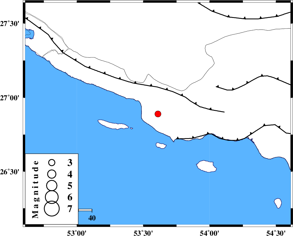
| Location | Lat:26.89 Lon: 53.61 |
| Region | Hormozgan Province, 66 km South-East of Lamerd |
Nearest Cities |
|
| 33 km South West of Ahl, Fars Province | |
| 37 km South of Ashkenan, Fars Province | |
| 60 km South of Beyram, Fars Province | |
| 66 km South East of Lamerd, Fars Province | |
| 68 km South West of Jenah, Hormozgan Province | |
| Depth | 14 km |
| Agency | |
Faults within 150 km: |
|
| MFF3 (Length: 292 km) , Distance to epicenter: 19 km | |
| ZFF1 (Length: 165 km) , Distance to epicenter: 23 km | |
| MFF1 (Length: 180 km) , Distance to epicenter: 48 km | |
| Number of Phases | 5 |
| RMS | 0 |
| Number of Stations | 3 |
| Error in Latitude | >9.6 km |
| Error in Longitude | 5.6 km |
| Error in Depth | 10 km |
Download waveform in seisan format
to download seisan software Click here
to access information about IIEES stations Click here
Amplitude | ||||||||
| UID | Agency | Station | Component | Amplitude | Period | Arrival Time | Proccessing Time | Signal Clip |
| 66470 | IIEES | GHIR | N | 416.2 | 0.52 | 2010-07-22 21:40:20 | 2010-07-23 01:49:00 | n |
| 66471 | IIEES | GHIR | E | 368.1 | 0.52 | 2010-07-22 21:40:30 | 2010-07-23 01:49:00 | n |
| 66472 | IIEES | BNDS | E | 53.9 | 0.56 | 2010-07-22 21:40:48 | 2010-07-23 01:49:00 | n |
| 66473 | IIEES | BNDS | N | 46.8 | 0.56 | 2010-07-22 21:41:05 | 2010-07-23 01:49:00 | n |
Phase | ||||||||||||
| Agency | Station | Component | Phase Type | Phase Quality | First Motion | Observed Arrival Time | Time Residual | Loc. Flag | Input Weight | Distance | Azimuth | |
| IIEES | GHIR | Z | Pn | E | 2010-07-22 21:39:56 | 0 | y | 166 | 338 | |||
| IIEES | GHIR | N | Sg | E | 2010-07-22 21:40:16 | 0 | y | 166 | 338 | |||
| IIEES | BNDS | Z | Pn | E | 2010-07-22 21:40:08 | 0 | y | 260 | 77 | |||
| IIEES | BNDS | N | Sg | E | 2010-07-22 21:40:41 | 0 | y | 260 | 77 | |||
| IIEES | KRBR | Z | Pn | E | 2010-07-22 21:40:33 | 0 | y | 461 | 41 | |||