
Magnitude |
3.1 |
| Date & Time (UTC) | 2010-07-24 16:49:36.6 |
| Date & Time (Local) | 1389/5/2 21:19:36.6 |
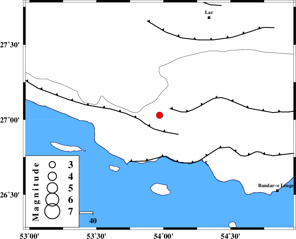
| Location | Lat:27.03 Lon: 53.97 |
| Region | Hormozgan Province, 43 km South-West of Bastak |
Nearest Cities |
|
| 28 km South East of Ahl, Fars Province | |
| 31 km North West of Jenah, Hormozgan Province | |
| 41 km South East of Ashkenan, Fars Province | |
| 43 km South West of Bastak, Hormozgan Province | |
| 52 km South of Bagh, Fars Province | |
| Depth | 15 km |
| Agency | |
Faults within 150 km: |
|
| MFF1 (Length: 180 km) , Distance to epicenter: 9 km | |
| MFF3 (Length: 292 km) , Distance to epicenter: 11 km | |
| ZFF1 (Length: 165 km) , Distance to epicenter: 31 km | |
| Number of Phases | 3 |
| RMS | 0 |
| Number of Stations | 3 |
| Error in Latitude | >12 km |
| Error in Longitude | 5.4 km |
| Error in Depth | 0 km |
Download waveform in seisan format
to download seisan software Click here
to access information about IIEES stations Click here
Amplitude | ||||||||
| UID | Agency | Station | Component | Amplitude | Period | Arrival Time | Proccessing Time | Signal Clip |
| 66610 | IIEES | GHIR | N | 430.3 | 0 | 2010-07-24 16:50:28 | 2010-07-24 05:10:00 | n |
| 66611 | IIEES | GHIR | E | 360.6 | 1.13 | 2010-07-24 16:50:30 | 2010-07-24 05:10:00 | n |
| 66612 | IIEES | BNDS | N | 142 | 0.42 | 2010-07-24 16:50:49 | 2010-07-24 05:10:00 | n |
| 66613 | IIEES | BNDS | E | 105.8 | 1.1 | 2010-07-24 16:50:50 | 2010-07-24 05:10:00 | n |
| 66614 | IIEES | KRBR | E | 15.7 | 1.65 | 2010-07-24 16:51:54 | 2010-07-24 05:10:00 | n |
Phase | ||||||||||||
| Agency | Station | Component | Phase Type | Phase Quality | First Motion | Observed Arrival Time | Time Residual | Loc. Flag | Input Weight | Distance | Azimuth | |
| IIEES | GHIR | Z | Pg | E | 2010-07-24 16:50:04 | 0 | y | 170 | 325 | |||
| IIEES | BNDS | Z | Pg | E | 2010-07-24 16:50:13 | 0 | y | 222 | 79 | |||
| IIEES | KRBR | Z | Pn | E | 2010-07-24 16:50:37 | 0 | y | 427 | 39 | |||