
Magnitude |
2.7 |
| Date & Time (UTC) | 2010-08-01 12:37:02.4 |
| Date & Time (Local) | 1389/5/10 17:07:02.4 |
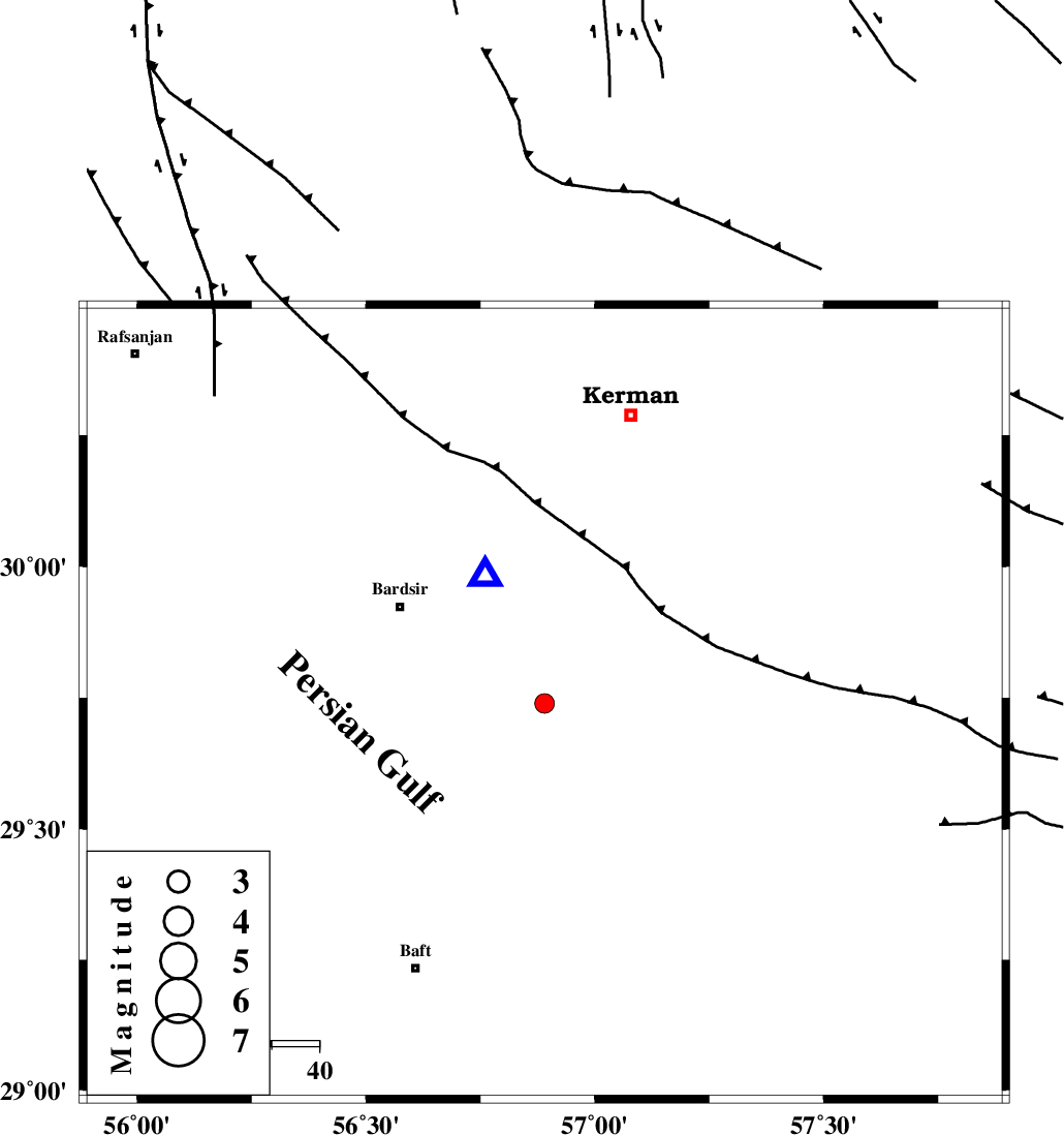
| Location | Lat:29.74 Lon: 56.89 |
| Region | Kerman Province, 37 km South-East of Bardsir |
Nearest Cities |
|
| 16 km South of Negar, Kerman Province | |
| 26 km North of Lalehzar, Kerman Province | |
| 28 km South East of Dashtkar, Kerman Province | |
| 32 km North East of Ghale-ye asgar, Kerman Province | |
| 37 km South East of Bardsir, Kerman Province | |
| Depth | 8 km |
| Agency | |
Faults within 150 km: |
|
| LALEHZAR_F (Length: 52 km) , Distance to epicenter: 29 km | |
| RAFSANJAN_F (Length: 129 km) , Distance to epicenter: 60 km | |
| GOWK_F (Length: 152 km) , Distance to epicenter: 66 km | |
| Number of Phases | 5 |
| RMS | 0 |
| Number of Stations | 3 |
| Error in Latitude | >1.9 km |
| Error in Longitude | 5.7 km |
| Error in Depth | 4.3 km |
Download waveform in seisan format
to download seisan software Click here
to access information about IIEES stations Click here
Amplitude | ||||||||
| UID | Agency | Station | Component | Amplitude | Period | Arrival Time | Proccessing Time | Signal Clip |
| 67394 | IIEES | KRBR | E | 1034.4 | 0.24 | 2010-08-01 12:37:18 | 2010-08-01 01:46:00 | n |
| 67395 | IIEES | BNDS | E | 46 | 0.32 | 2010-08-01 12:38:19 | 2010-08-01 01:46:00 | n |
Phase | ||||||||||||
| Agency | Station | Component | Phase Type | Phase Quality | First Motion | Observed Arrival Time | Time Residual | Loc. Flag | Input Weight | Distance | Azimuth | |
| IIEES | KRBR | Z | Pg | E | 2010-08-01 12:37:08 | 0 | y | 29.9 | 335 | |||
| IIEES | KRBR | N | Sg | E | 2010-08-01 12:37:12 | 0 | y | 29.9 | 335 | |||
| IIEES | BNDS | Z | Pn | E | 2010-08-01 12:37:44 | 0 | y | 268 | 195 | |||
| IIEES | BNDS | N | S | E | 2010-08-01 12:38:14 | 0 | y | 268 | 195 | |||
| IIEES | TABS | Z | Pn | E | 2010-08-01 12:38:04 | 0 | y | 434 | 3 | |||