
Magnitude |
3.4 |
| Date & Time (UTC) | 2010-08-18 01:01:46.5 |
| Date & Time (Local) | 1389/5/27 05:31:46.5 |
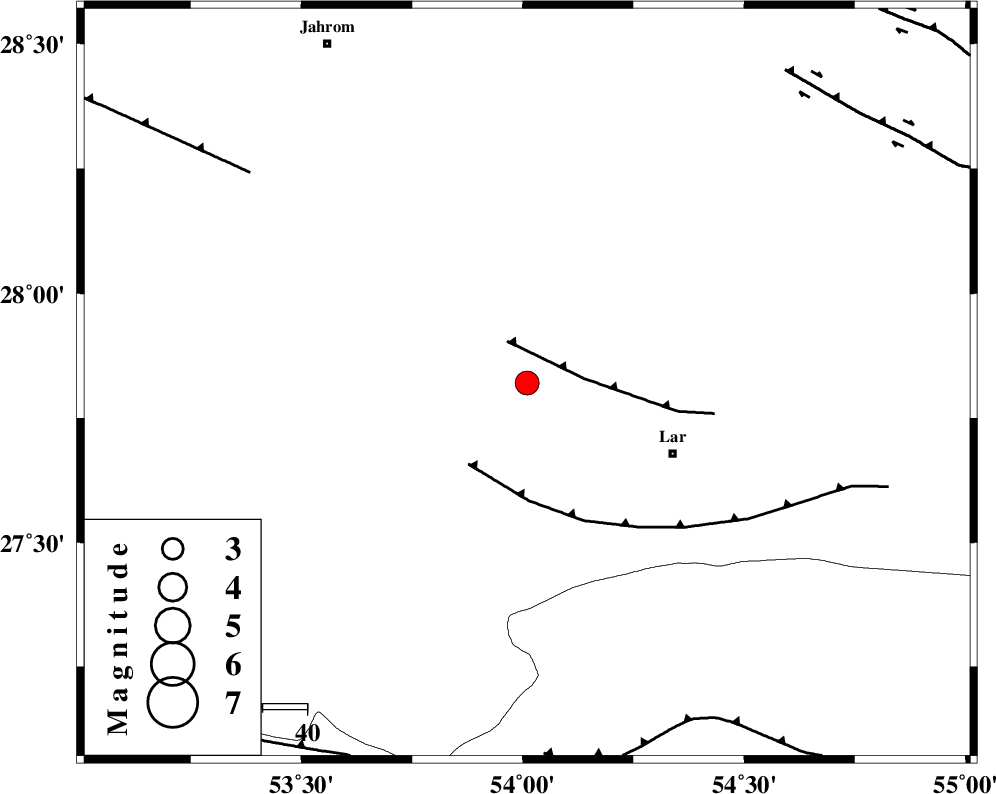
| Location | Lat:27.82 Lon: 54.01 |
| Region | Fars Province, 36 km North-West of Lar |
Nearest Cities |
|
| 6 km North of Avaz, Fars Province | |
| 23 km South East of Kureh, Fars Province | |
| 24 km North West of Grash, Fars Province | |
| 32 km North East of Fishur, Fars Province | |
| 36 km North of Bagh, Fars Province | |
| Depth | 14 km |
| Agency | |
Faults within 150 km: |
|
| BERIZ_F (Length: 49 km) , Distance to epicenter: 10 km | |
| LAR_F (Length: 99 km) , Distance to epicenter: 22 km | |
| QIR_F (Length: 130 km) , Distance to epicenter: 77 km | |
| Number of Phases | 5 |
| RMS | 0.1 |
| Number of Stations | 4 |
| Error in Latitude | >11.9 km |
| Error in Longitude | 4.3 km |
| Error in Depth | 6.6 km |
Download waveform in seisan format
to download seisan software Click here
to access information about IIEES stations Click here
Amplitude | ||||||||
| UID | Agency | Station | Component | Amplitude | Period | Arrival Time | Proccessing Time | Signal Clip |
| 69450 | IIEES | GHIR | E | 892 | 0.84 | 2010-08-18 01:02:29 | 2010-08-29 12:45:00 | n |
| 69451 | IIEES | GHIR | N | 1315.8 | 0 | 2010-08-18 01:02:38 | 2010-08-29 12:45:00 | n |
| 69452 | IIEES | KRBR | N | 54.9 | 1.01 | 2010-08-18 01:03:45 | 2010-08-29 12:45:00 | n |
| 69453 | IIEES | NASN | E | 18.7 | 0.15 | 2010-08-18 01:04:12 | 2010-08-29 12:45:00 | n |
| 69454 | IIEES | NASN | N | 50.7 | 0.8 | 2010-08-18 01:04:12 | 2010-08-29 12:45:00 | n |
Phase | ||||||||||||
| Agency | Station | Component | Phase Type | Phase Quality | First Motion | Observed Arrival Time | Time Residual | Loc. Flag | Input Weight | Distance | Azimuth | |
| IIEES | GHIR | Z | Pg | E | 2010-08-18 01:02:05 | 0.1 | y | 113 | 298 | |||
| IIEES | AHRM | Z | Pn | E | 2010-08-18 01:02:29 | -0.2 | y | 290 | 294 | |||
| IIEES | KRBR | Z | Pn | E | 2010-08-18 01:02:39 | 0.1 | y | 360 | 48 | |||
| IIEES | KRBR | N | Sg | E | 2010-08-18 01:03:27 | -0.1 | y | 360 | 48 | |||
| IIEES | NASN | Z | Pn | E | 2010-08-18 01:03:04 | 0.1 | y | 564 | 348 | |||