
Magnitude |
3 |
| Date & Time (UTC) | 2010-08-25 01:16:49.6 |
| Date & Time (Local) | 1389/6/3 05:46:49.6 |
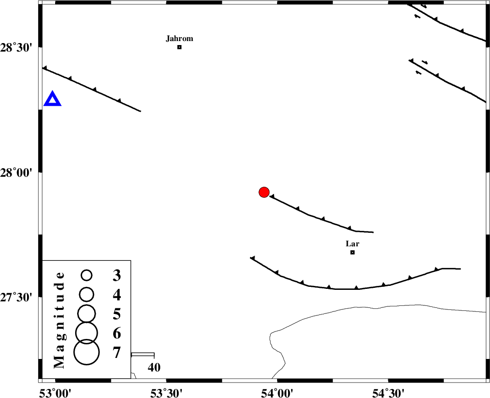
| Location | Lat:27.92 Lon: 53.94 |
| Region | Fars Province, 47 km North-West of Lar |
Nearest Cities |
|
| 14 km East of Kureh, Fars Province | |
| 19 km North of Avaz, Fars Province | |
| 28 km North East of Fishur, Fars Province | |
| 30 km South of Juyam, Fars Province | |
| 37 km North West of Grash, Fars Province | |
| Depth | 30 km |
| Agency | |
Faults within 150 km: |
|
| BERIZ_F (Length: 49 km) , Distance to epicenter: 3 km | |
| LAR_F (Length: 99 km) , Distance to epicenter: 30 km | |
| QIR_F (Length: 130 km) , Distance to epicenter: 65 km | |
| Number of Phases | 4 |
| RMS | 0 |
| Number of Stations | 4 |
| Error in Latitude | >8.4 km |
| Error in Longitude | 3 km |
| Error in Depth | 4.2 km |
Download waveform in seisan format
to download seisan software Click here
to access information about IIEES stations Click here
Amplitude | ||||||||
| UID | Agency | Station | Component | Amplitude | Period | Arrival Time | Proccessing Time | Signal Clip |
| 69562 | IIEES | GHIR | E | 402.6 | 0.89 | 2010-08-25 01:17:39 | 2010-08-29 12:45:00 | n |
| 69563 | IIEES | KRBR | N | 34.2 | 0.38 | 2010-08-25 01:18:51 | 2010-08-29 12:45:00 | n |
Phase | ||||||||||||
| Agency | Station | Component | Phase Type | Phase Quality | First Motion | Observed Arrival Time | Time Residual | Loc. Flag | Input Weight | Distance | Azimuth | |
| IIEES | GHIR | Z | Pg | E | 2010-08-25 01:17:07 | 0 | y | 102 | 294 | |||
| IIEES | AHRM | Z | Pn | E | 2010-08-25 01:17:30 | 0 | y | 280 | 293 | |||
| IIEES | KRBR | Z | Pn | E | 2010-08-25 01:17:40 | 0 | y | 358 | 50 | |||
| IIEES | NASN | Z | Pn | E | 2010-08-25 01:18:04 | 0 | y | 552 | 349 | |||