
Magnitude |
3.1 |
| Date & Time (UTC) | 2010-09-05 06:56:13.7 |
| Date & Time (Local) | 1389/6/14 11:26:13.7 |
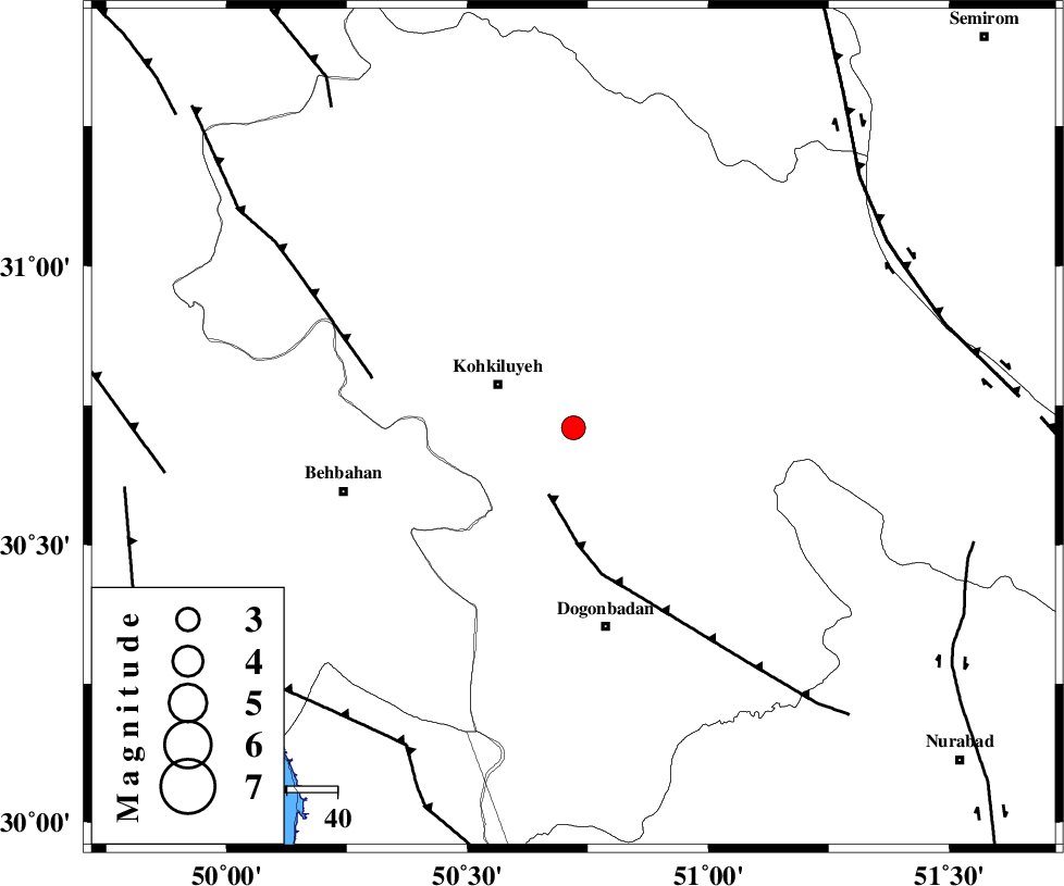
| Location | Lat:30.71 Lon: 50.72 |
| Region | Kohkiluieh va boyerahmad Province, 17 km East of Dehdasht |
Nearest Cities |
|
| 17 km East of Dehdasht, Kohkiluieh va boyerahmad Province | |
| 21 km South of Savari, Kohkiluieh va boyerahmad Province | |
| 40 km North of Dogonbadan, Kohkiluieh va boyerahmad Province | |
| 41 km South East of Lendeh, Kohkiluieh va boyerahmad Province | |
| 41 km North East of Mansuriyeh, Khoozestan Province | |
| Depth | 15 km |
| Agency | |
Faults within 150 km: |
|
| MISHAN_F (Length: 76 km) , Distance to epicenter: 14 km | |
| MFF4 (Length: 62 km) , Distance to epicenter: 41 km | |
| RAG_E_SEFID_F (Length: 84 km) , Distance to epicenter: 72 km | |
| Number of Phases | 5 |
| RMS | 0.1 |
| Number of Stations | 5 |
| Error in Latitude | >4.1 km |
| Error in Longitude | 6.2 km |
| Error in Depth | 9.9 km |
Download waveform in seisan format
to download seisan software Click here
to access information about IIEES stations Click here
Amplitude | ||||||||
| UID | Agency | Station | Component | Amplitude | Period | Arrival Time | Proccessing Time | Signal Clip |
| 69930 | IIEES | SHGR | N | 137.8 | 0.4 | 2010-09-05 06:57:23 | 2010-09-05 07:14:00 | n |
Phase | ||||||||||||
| Agency | Station | Component | Phase Type | Phase Quality | First Motion | Observed Arrival Time | Time Residual | Loc. Flag | Input Weight | Distance | Azimuth | |
| IIEES | AHRM | Z | Pg | E | 2010-09-05 06:56:48 | 0 | y | 212 | 164 | |||
| IIEES | SHGR | Z | Pg | E | 2010-09-05 06:56:52 | 0 | y | 239 | 311 | |||
| IIEES | NASN | Z | Pn | E | 2010-09-05 06:56:59 | 0.1 | y | 305 | 40 | |||
| IIEES | KHMZ | Z | Pn | E | 2010-09-05 06:57:04 | 0 | y | 344 | 348 | |||
| IIEES | TABS | Z | Pn | E | 2010-09-05 06:57:46 | -0.2 | y | 686 | 60 | |||