
Magnitude |
2.6 |
| Date & Time (UTC) | 2010-09-19 11:11:03.6 |
| Date & Time (Local) | 1389/6/28 15:41:03.6 |
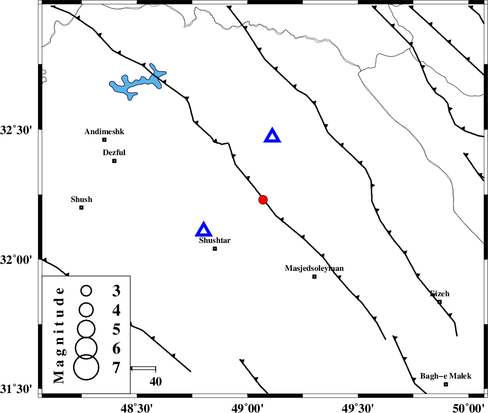
| Location | Lat:32.23 Lon: 49.07 |
| Region | Khoozestan Province, 18 km South of Lali |
Nearest Cities |
|
| 7 km of Jaefarabad, Khoozestan Province | |
| 11 km North of Haft shahidan, Khoozestan Province | |
| 18 km South of Lali, Khoozestan Province | |
| 21 km North East of Samaleh, Khoozestan Province | |
| 24 km East of Gatvand, Khoozestan Province | |
| Depth | 14 km |
| Agency | |
Faults within 150 km: |
|
| DEZFUL_EMBAYMENT (Length: 228 km) , Distance to epicenter: 8 km | |
| MFF2 (Length: 205 km) , Distance to epicenter: 30 km | |
| BALARUD_F_Z2 (Length: 58 km) , Distance to epicenter: 54 km | |
| Number of Phases | 4 |
| RMS | 0.1 |
| Number of Stations | 4 |
| Error in Latitude | >4 km |
| Error in Longitude | 5.4 km |
| Error in Depth | 6 km |
Download waveform in seisan format
to download seisan software Click here
to access information about IIEES stations Click here
Amplitude | ||||||||
| UID | Agency | Station | Component | Amplitude | Period | Arrival Time | Proccessing Time | Signal Clip |
| 70690 | IIEES | SHGR | E | 984.9 | 0.39 | 2010-09-19 11:11:18 | 2010-09-19 11:20:00 | n |
Phase | ||||||||||||
| Agency | Station | Component | Phase Type | Phase Quality | First Motion | Observed Arrival Time | Time Residual | Loc. Flag | Input Weight | Distance | Azimuth | |
| IIEES | SHGR | Z | Pg | E | 2010-09-19 11:11:09 | 0 | y | 29.2 | 242 | |||
| IIEES | KHMZ | Z | Pg | E | 2010-09-19 11:11:34 | -0.2 | y | 187 | 26 | |||
| IIEES | ASAO | Z | Pn | E | 2010-09-19 11:11:45 | 0.2 | y | 272 | 19 | |||
| IIEES | NASN | Z | Pn | E | 2010-09-19 11:11:55 | 0 | y | 356 | 79 | |||