
Magnitude |
2.9 |
| Date & Time (UTC) | 2010-09-20 08:21:50.4 |
| Date & Time (Local) | 1389/6/29 12:51:50.4 |
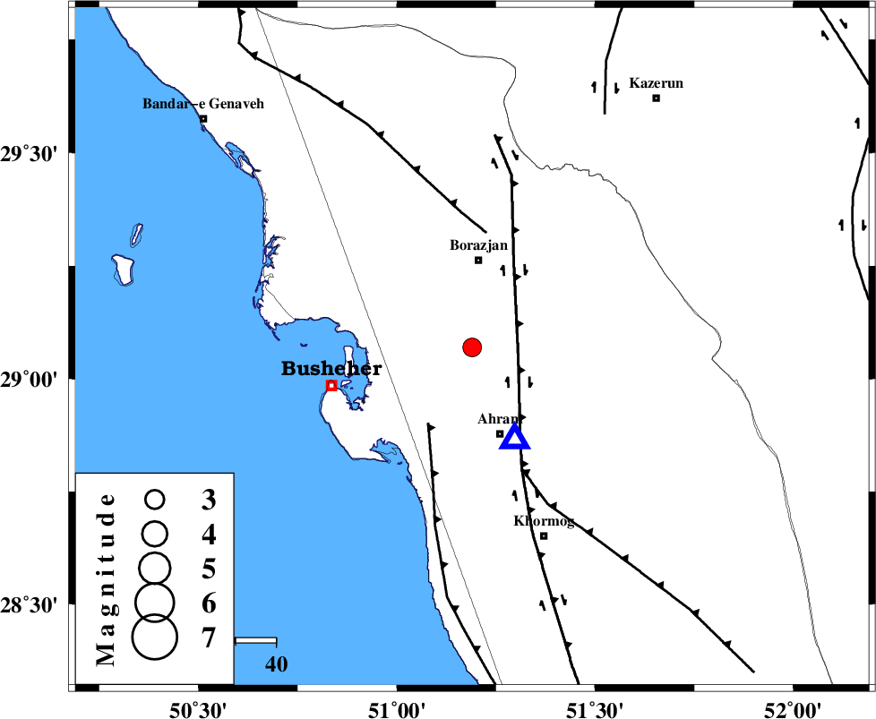
| Location | Lat:29.07 Lon: 51.19 |
| Region | Bushehr Province, 21 km South of Borazjan |
Nearest Cities |
|
| 14 km South of Sarkareh, Bushehr Province | |
| 16 km North of Bazuei, Bushehr Province | |
| 18 km North East of Choghadak, Bushehr Province | |
| 21 km South of Borazjan, Bushehr Province | |
| 22 km North of Ahram, Bushehr Province | |
| Depth | 17 km |
| Agency | |
Faults within 150 km: |
|
| BORAZJAN_F (Length: 168 km) , Distance to epicenter: 12 km | |
| ZFF2 (Length: 84 km) , Distance to epicenter: 21 km | |
| ZFF3 (Length: 125 km) , Distance to epicenter: 28 km | |
| Number of Phases | 5 |
| RMS | 0 |
| Number of Stations | 3 |
| Error in Latitude | >1.3 km |
| Error in Longitude | 1.3 km |
| Error in Depth | 0 km |
Download waveform in seisan format
to download seisan software Click here
to access information about IIEES stations Click here
Amplitude | ||||||||
| UID | Agency | Station | Component | Amplitude | Period | Arrival Time | Proccessing Time | Signal Clip |
| 70730 | IIEES | GHIR | N | 136.1 | 0.44 | 2010-09-20 08:22:51 | 2010-09-20 08:34:00 | n |
| 70731 | IIEES | GHIR | E | 125.1 | 0.57 | 2010-09-20 08:22:53 | 2010-09-20 08:34:00 | n |
Phase | ||||||||||||
| Agency | Station | Component | Phase Type | Phase Quality | First Motion | Observed Arrival Time | Time Residual | Loc. Flag | Input Weight | Distance | Azimuth | |
| IIEES | AHRM | Z | Pg | E | 2010-09-20 08:21:55 | 0 | y | 25.4 | 156 | |||
| IIEES | AHRM | N | Sg | E | 2010-09-20 08:21:59 | 0 | y | 25.4 | 156 | |||
| IIEES | GHIR | Z | Pg | E | 2010-09-20 08:22:22 | 0 | y | 196 | 116 | |||
| IIEES | GHIR | N | Sg | E | 2010-09-20 08:22:46 | 0 | y | 196 | 116 | |||
| IIEES | NASN | Z | Pn | E | 2010-09-20 08:22:52 | 0 | y | 441 | 20 | |||