
Magnitude |
2.6 |
| Date & Time (UTC) | 2010-09-21 08:33:16.5 |
| Date & Time (Local) | 1389/6/30 13:03:16.5 |
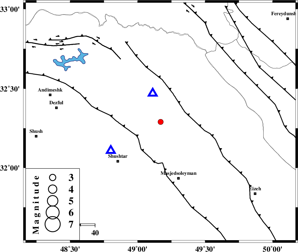
| Location | Lat:32.29 Lon: 49.17 |
| Region | Khoozestan Province, 12 km Lali |
Nearest Cities |
|
| 5 km North of Jaefarabad, Khoozestan Province | |
| 12 km of Lali, Khoozestan Province | |
| 20 km North East of Haft shahidan, Khoozestan Province | |
| 27 km North West of Qale-yekhvaju, Khoozestan Province | |
| 32 km North East of Samaleh, Khoozestan Province | |
| Depth | 28 km |
| Agency | |
Faults within 150 km: |
|
| MFF2 (Length: 205 km) , Distance to epicenter: 18 km | |
| DEZFUL_EMBAYMENT (Length: 228 km) , Distance to epicenter: 19 km | |
| BALARUD_F_Z2 (Length: 58 km) , Distance to epicenter: 52 km | |
| Number of Phases | 4 |
| RMS | 0 |
| Number of Stations | 4 |
| Error in Latitude | >6.6 km |
| Error in Longitude | 6.8 km |
| Error in Depth | 4.5 km |
Download waveform in seisan format
to download seisan software Click here
to access information about IIEES stations Click here
Amplitude | ||||||||
| UID | Agency | Station | Component | Amplitude | Period | Arrival Time | Proccessing Time | Signal Clip |
| 70770 | IIEES | SHGR | N | 537.6 | 0.36 | 2010-09-21 08:33:35 | 2010-09-21 08:43:00 | n |
Phase | ||||||||||||
| Agency | Station | Component | Phase Type | Phase Quality | First Motion | Observed Arrival Time | Time Residual | Loc. Flag | Input Weight | Distance | Azimuth | |
| IIEES | SHGR | Z | Pg | E | 2010-09-21 08:33:24 | 0 | y | 40.1 | 240 | |||
| IIEES | KHMZ | Z | Pg | E | 2010-09-21 08:33:45 | 0 | y | 177 | 25 | |||
| IIEES | ASAO | Z | Pn | E | 2010-09-21 08:33:55 | 0 | y | 263 | 17 | |||
| IIEES | SNGE | Z | Pn | E | 2010-09-21 08:34:07 | 0 | y | 354 | 332 | |||