
Magnitude |
3 |
| Date & Time (UTC) | 2010-10-07 07:58:53.0 |
| Date & Time (Local) | 1389/7/15 11:28:53.0 |
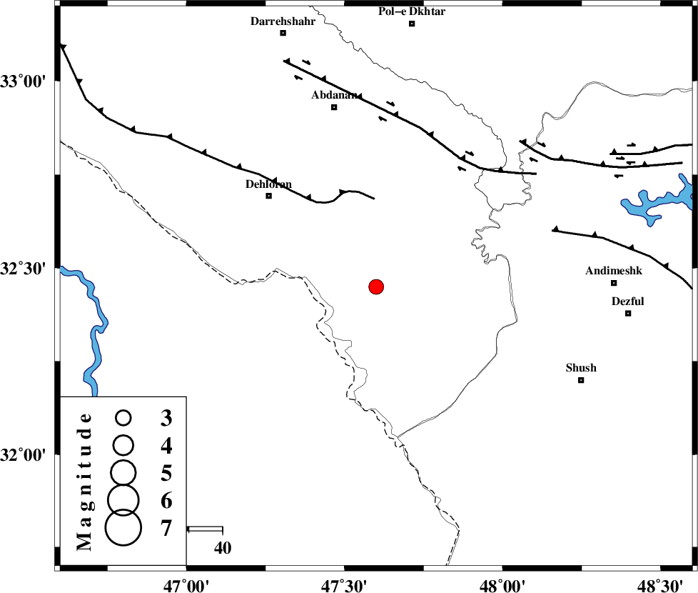
| Location | Lat:32.45 Lon: 47.6 |
| Region | Ilam Province, 42 km South-East of Dehloran |
Nearest Cities |
|
| 25 km East of Musian, Ilam Province | |
| 42 km South East of Dehloran, Ilam Province | |
| 50 km South of Sarabbagh, Ilam Province | |
| 55 km South East of Abdanan, Ilam Province | |
| 66 km South West of Hoseinieh, Khoozestan Province | |
| Depth | 14 km |
| Agency | |
Faults within 150 km: |
|
| MFF6 (Length: 144 km) , Distance to epicenter: 26 km | |
| BALARUD_F_Z1 (Length: 87 km) , Distance to epicenter: 46 km | |
| DEZFUL_EMBAYMENT (Length: 228 km) , Distance to epicenter: 55 km | |
| Number of Phases | 5 |
| RMS | 0.2 |
| Number of Stations | 4 |
| Error in Latitude | >5 km |
| Error in Longitude | 8.6 km |
| Error in Depth | 12.3 km |
Download waveform in seisan format
to download seisan software Click here
to access information about IIEES stations Click here
Amplitude | ||||||||
| UID | Agency | Station | Component | Amplitude | Period | Arrival Time | Proccessing Time | Signal Clip |
| 71530 | IIEES | SHGR | N | 624.6 | 0.28 | 2010-10-07 07:59:32 | 2010-10-07 08:12:00 | n |
| 71531 | IIEES | SHGR | E | 799.1 | 0.58 | 2010-10-07 07:59:33 | 2010-10-07 08:12:00 | n |
| 71532 | IIEES | KHMZ | N | 48 | 0.44 | 2010-10-07 08:00:18 | 2010-10-07 08:12:00 | n |
| 71533 | IIEES | SNGE | E | 35.9 | 0.49 | 2010-10-07 08:00:25 | 2010-10-07 08:12:00 | n |
| 71534 | IIEES | SNGE | N | 40 | 0.88 | 2010-10-07 08:00:28 | 2010-10-07 08:12:00 | n |
Phase | ||||||||||||
| Agency | Station | Component | Phase Type | Phase Quality | First Motion | Observed Arrival Time | Time Residual | Loc. Flag | Input Weight | Distance | Azimuth | |
| IIEES | SHGR | Z | Pg | E | 2010-10-07 07:59:13 | 0.1 | y | 119 | 108 | |||
| IIEES | KHMZ | Z | Pg | E | 2010-10-07 07:59:35 | -0.3 | y | 263 | 56 | |||
| IIEES | KHMZ | N | Sg | E | 2010-10-07 08:00:07 | 0.2 | y | 263 | 56 | |||
| IIEES | SNGE | Z | Pn | E | 2010-10-07 07:59:37 | 0.2 | y | 294 | 355 | |||
| IIEES | GHVR | Z | Pn | E | 2010-10-07 07:59:51 | -0.1 | y | 406 | 55 | |||