
Magnitude |
3.2 |
| Date & Time (UTC) | 2010-10-12 15:15:52.5 |
| Date & Time (Local) | 1389/7/20 18:45:52.5 |
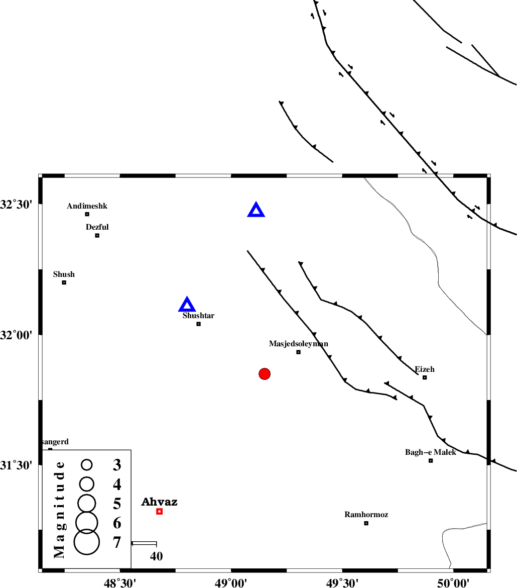
| Location | Lat:31.85 Lon: 49.15 |
| Region | Khoozestan Province, 17 km West of Masjed Soleyman |
Nearest Cities |
|
| 17 km West of Masjed Soleyman, Khoozestan Province | |
| 24 km North East of Arabhasan, Khoozestan Province | |
| 31 km East of Mehdiabad, Khoozestan Province | |
| 33 km South of Haft shahidan, Khoozestan Province | |
| 34 km North East of Talieh, Khoozestan Province | |
| Depth | 14 km |
| Agency | |
Faults within 150 km: |
|
| DEZFUL_EMBAYMENT (Length: 228 km) , Distance to epicenter: 13 km | |
| MFF2 (Length: 205 km) , Distance to epicenter: 52 km | |
| AHVAZ_F (Length: 99 km) , Distance to epicenter: 69 km | |
| Number of Phases | 4 |
| RMS | 0.1 |
| Number of Stations | 4 |
| Error in Latitude | >7.4 km |
| Error in Longitude | 3.1 km |
| Error in Depth | 6 km |
Download waveform in seisan format
to download seisan software Click here
to access information about IIEES stations Click here
Amplitude | ||||||||
| UID | Agency | Station | Component | Amplitude | Period | Arrival Time | Proccessing Time | Signal Clip |
| 71710 | IIEES | SHGR | N | 2872.4 | 0.94 | 2010-10-12 15:16:09 | 2010-10-12 03:38:00 | n |
| 71711 | IIEES | SHGR | E | 2118.2 | 0.42 | 2010-10-12 15:16:10 | 2010-10-12 03:38:00 | n |
| 71712 | IIEES | SNGE | N | 36.8 | 0.21 | 2010-10-12 15:18:02 | 2010-10-12 03:38:00 | n |
Phase | ||||||||||||
| Agency | Station | Component | Phase Type | Phase Quality | First Motion | Observed Arrival Time | Time Residual | Loc. Flag | Input Weight | Distance | Azimuth | |
| IIEES | SHGR | Z | Pg | E | 2010-10-12 15:16:00 | -0.1 | y | 43.9 | 311 | |||
| IIEES | KHMZ | Z | Pg | E | 2010-10-12 15:16:29 | 0 | y | 223 | 20 | |||
| IIEES | NASN | Z | Pn | E | 2010-10-12 15:16:45 | 0 | y | 360 | 72 | |||
| IIEES | SNGE | Z | Pn | E | 2010-10-12 15:16:49 | 0.2 | y | 397 | 336 | |||