
Magnitude |
2.6 |
| Date & Time (UTC) | 2010-10-20 13:19:46.5 |
| Date & Time (Local) | 1389/7/28 16:49:46.5 |
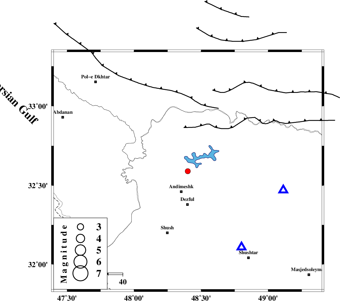
| Location | Lat:32.59 Lon: 48.4 |
| Region | Khoozestan Province, 15 km North of Andimeshk |
Nearest Cities |
|
| 15 km North of Andimeshk, Khoozestan Province | |
| 17 km East of Hoseinieh, Khoozestan Province | |
| 22 km South of Sorkhakan, Khoozestan Province | |
| 23 km North of Dezful, Khoozestan Province | |
| 24 km South East of Bidruyeh, Khoozestan Province | |
| Depth | 15 km |
| Agency | |
Faults within 150 km: |
|
| DEZFUL_EMBAYMENT (Length: 228 km) , Distance to epicenter: 8 km | |
| BALARUD_F_Z3 (Length: 53 km) , Distance to epicenter: 20 km | |
| BALARUD_F_Z2 (Length: 58 km) , Distance to epicenter: 24 km | |
| Number of Phases | 3 |
| RMS | 0 |
| Number of Stations | 3 |
| Error in Latitude | >1.6 km |
| Error in Longitude | 3.2 km |
| Error in Depth | 0 km |
Download waveform in seisan format
to download seisan software Click here
to access information about IIEES stations Click here
Amplitude | ||||||||
| UID | Agency | Station | Component | Amplitude | Period | Arrival Time | Proccessing Time | Signal Clip |
| 72150 | IIEES | SHGR | N | 305.1 | 0.42 | 2010-10-20 13:20:17 | 2010-10-20 01:33:00 | n |
| 72151 | IIEES | SHGR | E | 290.2 | 0.62 | 2010-10-20 13:20:18 | 2010-10-20 01:33:00 | n |
| 72152 | IIEES | KHMZ | E | 50.2 | 0.46 | 2010-10-20 13:20:47 | 2010-10-20 01:33:00 | n |
| 72153 | IIEES | KHMZ | N | 47.6 | 0 | 2010-10-20 13:20:49 | 2010-10-20 01:33:00 | n |
| 72154 | IIEES | SNGE | N | 27.6 | 1.83 | 2010-10-20 13:21:19 | 2010-10-20 01:33:00 | n |
| 72155 | IIEES | SNGE | E | 32.9 | 0.39 | 2010-10-20 13:21:19 | 2010-10-20 01:33:00 | n |
Phase | ||||||||||||
| Agency | Station | Component | Phase Type | Phase Quality | First Motion | Observed Arrival Time | Time Residual | Loc. Flag | Input Weight | Distance | Azimuth | |
| IIEES | SHGR | Z | Pg | E | 2010-10-20 13:19:57 | 0 | y | 65.2 | 144 | |||
| IIEES | KHMZ | Z | Pg | E | 2010-10-20 13:20:18 | 0 | y | 194 | 48 | |||
| IIEES | SNGE | Z | Pn | E | 2010-10-20 13:20:30 | 0 | y | 295 | 341 | |||