
Magnitude |
3.2 |
| Date & Time (UTC) | 2010-11-05 14:01:37.9 |
| Date & Time (Local) | 1389/8/14 17:31:37.9 |
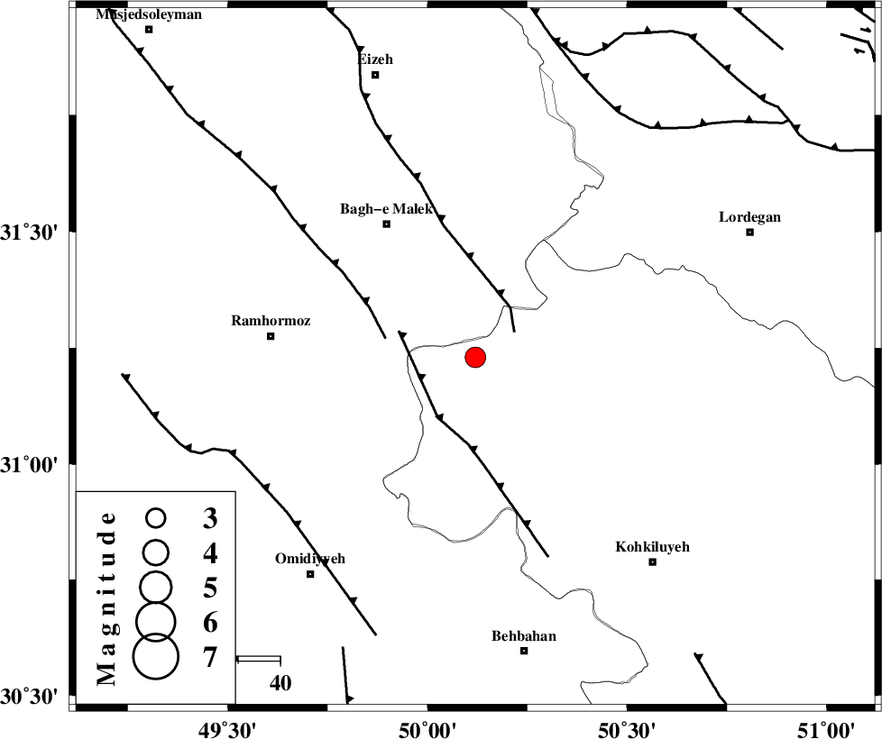
| Location | Lat:31.23 Lon: 50.12 |
| Region | Kohkiluieh va boyerahmad Province, 39 km South-East of Bagh Malek |
Nearest Cities |
|
| 15 km South of Seidun, Khoozestan Province | |
| 17 km West of Esfandan, Kohkiluieh va boyerahmad Province | |
| 25 km East of Dalan, Khoozestan Province | |
| 27 km West of Dishmuk, Kohkiluieh va boyerahmad Province | |
| 31 km North West of Qale-ye raiesi, Kohkiluieh va boyerahmad Province | |
| Depth | 14 km |
| Agency | |
Faults within 150 km: |
|
| MFF2 (Length: 205 km) , Distance to epicenter: 11 km | |
| MFF4 (Length: 62 km) , Distance to epicenter: 17 km | |
| DEZFUL_EMBAYMENT (Length: 228 km) , Distance to epicenter: 22 km | |
| Number of Phases | 5 |
| RMS | 0.4 |
| Number of Stations | 3 |
| Error in Latitude | >11.4 km |
| Error in Longitude | 11.7 km |
| Error in Depth | 19.5 km |
Download waveform in seisan format
to download seisan software Click here
to access information about IIEES stations Click here
Amplitude | ||||||||
| UID | Agency | Station | Component | Amplitude | Period | Arrival Time | Proccessing Time | Signal Clip |
| 72910 | IIEES | SHGR | N | 1051.2 | 1.2 | 2010-11-05 14:02:27 | 2010-11-05 02:32:00 | n |
| 72911 | IIEES | KHMZ | E | 71.4 | 0.62 | 2010-11-05 14:03:04 | 2010-11-05 02:32:00 | n |
| 72912 | IIEES | ASAO | E | 39.6 | 0.96 | 2010-11-05 14:03:17 | 2010-11-05 02:32:00 | n |
Phase | ||||||||||||
| Agency | Station | Component | Phase Type | Phase Quality | First Motion | Observed Arrival Time | Time Residual | Loc. Flag | Input Weight | Distance | Azimuth | |
| IIEES | SHGR | Z | Pg | E | 2010-11-05 14:02:03 | -0.5 | y | 159 | 308 | |||
| IIEES | SHGR | E | Sg | E | 2010-11-05 14:02:23 | 0.3 | y | 159 | 308 | |||
| IIEES | KHMZ | Z | Pn | E | 2010-11-05 14:02:20 | 0 | y | 279 | 357 | |||
| IIEES | KHMZ | E | Sg | E | 2010-11-05 14:02:56 | -0.2 | y | 279 | 357 | |||
| IIEES | ASAO | Z | Pn | E | 2010-11-05 14:02:32 | 0.4 | y | 369 | 359 | |||