
Magnitude |
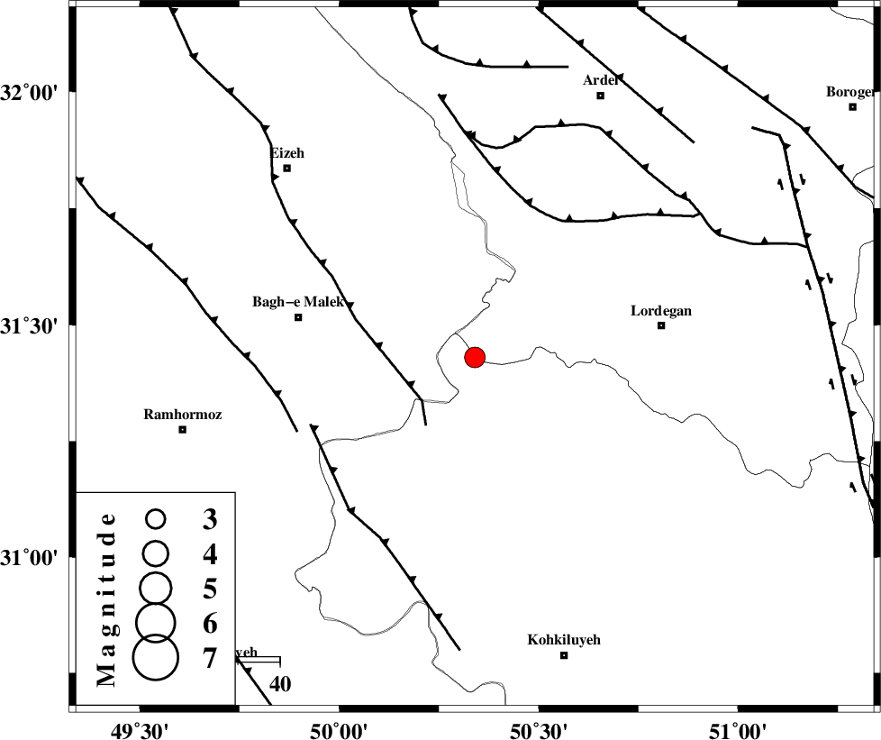
3.2 |
| Date & Time (UTC) | 2010-12-15 19:51:33.7 |
| Date & Time (Local) | 1389/9/24 23:21:33.7 |
| Location | Lat:31.43 Lon: 50.34 |
| Region | Kohkiluieh va boyerahmad Province, 45 km West of Lordegan |
Nearest Cities |
|
| 16 km North of Dishmuk, Kohkiluieh va boyerahmad Province | |
| 17 km North of Esfandan, Kohkiluieh va boyerahmad Province | |
| 26 km North East of Seidun, Khoozestan Province | |
| 28 km North of Qale-ye raiesi, Kohkiluieh va boyerahmad Province | |
| 33 km North West of Pataveh, Kohkiluieh va boyerahmad Province | |
| Depth | 16 km |
| Agency | |
Faults within 150 km: |
|
| MFF2 (Length: 205 km) , Distance to epicenter: 16 km | |
| SABZKUH_F (Length: 67 km) , Distance to epicenter: 38 km | |
| MFF4 (Length: 62 km) , Distance to epicenter: 42 km | |
| Number of Phases | 6 |
| RMS | 0.1 |
| Number of Stations | 4 |
| Error in Latitude | >2.6 km |
| Error in Longitude | 1.6 km |
| Error in Depth | 3.4 km |
Download waveform in seisan format
to download seisan software Click here
to access information about IIEES stations Click here
Amplitude | ||||||||
| UID | Agency | Station | Component | Amplitude | Period | Arrival Time | Proccessing Time | Signal Clip |
| 75470 | IIEES | SHGR | E | 639.7 | 0.6 | 2010-12-15 19:52:27 | 2010-12-15 08:17:00 | n |
| 75471 | IIEES | SHGR | N | 565.5 | 0.76 | 2010-12-15 19:52:33 | 2010-12-15 08:17:00 | n |
| 75472 | IIEES | ASAO | N | 80.3 | 0.72 | 2010-12-15 19:53:22 | 2010-12-15 08:17:00 | n |
| 75473 | IIEES | GHVR | E | 40.5 | 0.88 | 2010-12-15 19:53:25 | 2010-12-15 08:17:00 | n |
| 75474 | IIEES | GHVR | N | 19.3 | 0.76 | 2010-12-15 19:53:31 | 2010-12-15 08:17:00 | n |
Phase | ||||||||||||
| Agency | Station | Component | Phase Type | Phase Quality | First Motion | Observed Arrival Time | Time Residual | Loc. Flag | Input Weight | Distance | Azimuth | |
| IIEES | SHGR | Z | Pg | E | 2010-12-15 19:52:00 | 0 | y | 164 | 298 | |||
| IIEES | NASN | Z | Pn | E | 2010-12-15 19:52:15 | -0.1 | y | 278 | 56 | |||
| IIEES | NASN | E | Sg | E | 2010-12-15 19:52:52 | 0 | y | 278 | 56 | |||
| IIEES | ASAO | Z | Pn | E | 2010-12-15 19:52:24 | 0 | y | 347 | 355 | |||
| IIEES | ASAO | N | Sg | E | 2010-12-15 19:53:11 | 0 | y | 347 | 355 | |||
| IIEES | GHVR | Z | Pn | E | 2010-12-15 19:52:24 | 0.1 | y | 349 | 14 | |||