
Magnitude |
3.2 |
| Date & Time (UTC) | 2010-12-21 09:37:13.2 |
| Date & Time (Local) | 1389/9/30 13:07:13.2 |
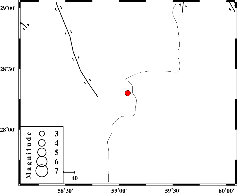
| Location | Lat:28.3 Lon: 59.08 |
| Region | Kerman Province, 114 km South-East of Bam |
Nearest Cities |
|
| 45 km South of Hoseynabad, Kerman Province | |
| 51 km South East of Mohammadabad-e gonbaki, Kerman Province | |
| 63 km North East of Borj-e abbasabad, Kerman Province | |
| 66 km South East of Void, Kerman Province | |
| 76 km South East of Fahroj, Kerman Province | |
| Depth | 39 km |
| Agency | |
Faults within 150 km: |
|
| BAM_F (Length: 118 km) , Distance to epicenter: 27 km | |
| KANURAK_F (Length: 135 km) , Distance to epicenter: 89 km | |
| GOWK_F (Length: 152 km) , Distance to epicenter: 110 km | |
| Number of Phases | 5 |
| RMS | 0.4 |
| Number of Stations | 4 |
| Error in Latitude | >8.1 km |
| Error in Longitude | 6.1 km |
| Error in Depth | 12.3 km |
Download waveform in seisan format
to download seisan software Click here
to access information about IIEES stations Click here
Amplitude | ||||||||
| UID | Agency | Station | Component | Amplitude | Period | Arrival Time | Proccessing Time | Signal Clip |
| 75970 | IIEES | KRBR | E | 75.3 | 0.43 | 2010-12-21 09:38:36 | 2010-12-21 02:31:00 | n |
| 75971 | IIEES | KRBR | N | 104.6 | 0.48 | 2010-12-21 09:38:39 | 2010-12-21 02:31:00 | n |
| 75972 | IIEES | TABS | E | 11.2 | 0.67 | 2010-12-21 09:40:26 | 2010-12-21 02:31:00 | n |
Phase | ||||||||||||
| Agency | Station | Component | Phase Type | Phase Quality | First Motion | Observed Arrival Time | Time Residual | Loc. Flag | Input Weight | Distance | Azimuth | |
| IIEES | ZHSF | Z | Pg | E | 2010-12-21 09:37:48 | 0.1 | y | 220 | 48 | |||
| IIEES | KRBR | Z | Pn | E | 2010-12-21 09:37:55 | 0.5 | y | 293 | 310 | |||
| IIEES | KRBR | N | Sg | E | 2010-12-21 09:38:33 | -0.1 | y | 293 | 310 | |||
| IIEES | CHBR | Z | Pn | E | 2010-12-21 09:37:59 | -0.1 | y | 331 | 155 | |||
| IIEES | TABS | Z | Pn | E | 2010-12-21 09:38:35 | -0.7 | y | 622 | 343 | |||