
Magnitude |
3 |
| Date & Time (UTC) | 2010-12-21 23:44:15.6 |
| Date & Time (Local) | 1389/10/1 03:14:15.6 |
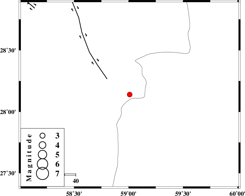
| Location | Lat:28.14 Lon: 59.01 |
| Region | Kerman Province, 131 km North-East of Kahnuj |
Nearest Cities |
|
| 50 km North East of Borj-e abbasabad, Kerman Province | |
| 63 km South of Hoseynabad, Kerman Province | |
| 65 km South East of Mohammadabad-e gonbaki, Kerman Province | |
| 82 km South East of Void, Kerman Province | |
| 85 km South East of Mardehak, Kerman Province | |
| Depth | 14 km |
| Agency | |
Faults within 150 km: |
|
| BAM_F (Length: 118 km) , Distance to epicenter: 25 km | |
| KANURAK_F (Length: 135 km) , Distance to epicenter: 108 km | |
| GOWK_F (Length: 152 km) , Distance to epicenter: 115 km | |
| Number of Phases | 5 |
| RMS | 0.3 |
| Number of Stations | 3 |
| Error in Latitude | >10.2 km |
| Error in Longitude | 4.1 km |
| Error in Depth | 18.6 km |
Download waveform in seisan format
to download seisan software Click here
to access information about IIEES stations Click here
Amplitude | ||||||||
| UID | Agency | Station | Component | Amplitude | Period | Arrival Time | Proccessing Time | Signal Clip |
| 76090 | IIEES | BNDS | N | 55.2 | 0.88 | 2010-12-21 23:45:48 | 2010-12-22 03:50:00 | n |
| 76091 | IIEES | BNDS | E | 52.4 | 0.63 | 2010-12-21 23:45:51 | 2010-12-22 03:50:00 | n |
| 76092 | IIEES | KRBR | E | 61.9 | 0.58 | 2010-12-21 23:45:43 | 2010-12-22 03:50:00 | n |
| 76093 | IIEES | KRBR | N | 79.6 | 1.16 | 2010-12-21 23:45:49 | 2010-12-22 03:50:00 | n |
Phase | ||||||||||||
| Agency | Station | Component | Phase Type | Phase Quality | First Motion | Observed Arrival Time | Time Residual | Loc. Flag | Input Weight | Distance | Azimuth | |
| IIEES | ZHSF | Z | Pg | E | 2010-12-21 23:44:54 | 0.3 | y | 237 | 46 | |||
| IIEES | ZHSF | E | Sg | E | 2010-12-21 23:45:22 | -0.3 | y | 237 | 46 | |||
| IIEES | BNDS | Z | Pn | E | 2010-12-21 23:44:59 | -0.3 | y | 291 | 254 | |||
| IIEES | KRBR | Z | Pn | E | 2010-12-21 23:45:01 | 0.5 | y | 300 | 314 | |||
| IIEES | KRBR | E | Sg | E | 2010-12-21 23:45:39 | -0.1 | y | 300 | 314 | |||