
Magnitude |
3.3 |
| Date & Time (UTC) | 2011-01-08 02:30:45.8 |
| Date & Time (Local) | 1389/10/18 06:00:45.8 |
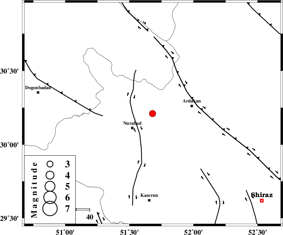
| Location | Lat:30.21 Lon: 51.68 |
| Region | Fars Province, 19 km East of Nurabad |
Nearest Cities |
|
| 17 km East of Masiri, Fars Province | |
| 19 km North East of Nurabad, Fars Province | |
| 20 km North East of Gachgaran, Fars Province | |
| 21 km North East of Fahlian-e olia, Fars Province | |
| 27 km North East of Ahangari, Fars Province | |
| Depth | 15 km |
| Agency | |
Faults within 150 km: |
|
| KAZERUN_F (Length: 96 km) , Distance to epicenter: 15 km | |
| HZF3 (Length: 197 km) , Distance to epicenter: 31 km | |
| MISHAN_F (Length: 76 km) , Distance to epicenter: 37 km | |
| Number of Phases | 5 |
| RMS | 0.5 |
| Number of Stations | 5 |
| Error in Latitude | >6.6 km |
| Error in Longitude | 9.1 km |
| Error in Depth | 0 km |
Download waveform in seisan format
to download seisan software Click here
to access information about IIEES stations Click here
Amplitude | ||||||||
| UID | Agency | Station | Component | Amplitude | Period | Arrival Time | Proccessing Time | Signal Clip |
| 76980 | IIEES | AHRM | E | 358.6 | 0.36 | 2011-01-08 02:31:36 | 2011-01-08 02:47:00 | n |
| 76981 | IIEES | AHRM | N | 607.5 | 0.52 | 2011-01-08 02:31:36 | 2011-01-08 02:47:00 | n |
| 76982 | IIEES | GHIR | N | 282.5 | 0.72 | 2011-01-08 02:32:08 | 2011-01-08 02:47:00 | n |
| 76983 | IIEES | GHIR | E | 248.8 | 0.52 | 2011-01-08 02:32:10 | 2011-01-08 02:47:00 | n |
| 76984 | IIEES | KRBR | N | 16.9 | 0.48 | 2011-01-08 02:32:49 | 2011-01-08 02:47:00 | n |
| 76985 | IIEES | KRBR | E | 19.4 | 0.76 | 2011-01-08 02:33:15 | 2011-01-08 02:47:00 | n |
Phase | ||||||||||||
| Agency | Station | Component | Phase Type | Phase Quality | First Motion | Observed Arrival Time | Time Residual | Loc. Flag | Input Weight | Distance | Azimuth | |
| IIEES | AHRM | Z | Pn | E | 2011-01-08 02:31:12 | 0.5 | y | 154 | 194 | |||
| IIEES | GHIR | Z | Pn | E | 2011-01-08 02:31:23 | -0.6 | y | 249 | 149 | |||
| IIEES | NASN | Z | Pn | E | 2011-01-08 02:31:32 | 0.4 | y | 306 | 20 | |||
| IIEES | KHMZ | Z | Pn | E | 2011-01-08 02:31:45 | -0.6 | y | 423 | 338 | |||
| IIEES | KRBR | Z | Pn | E | 2011-01-08 02:31:54 | 0.2 | y | 491 | 92 | |||