
Magnitude |
3.2 |
| Date & Time (UTC) | 2011-02-04 20:01:31.9 |
| Date & Time (Local) | 1389/11/15 23:31:31.9 |
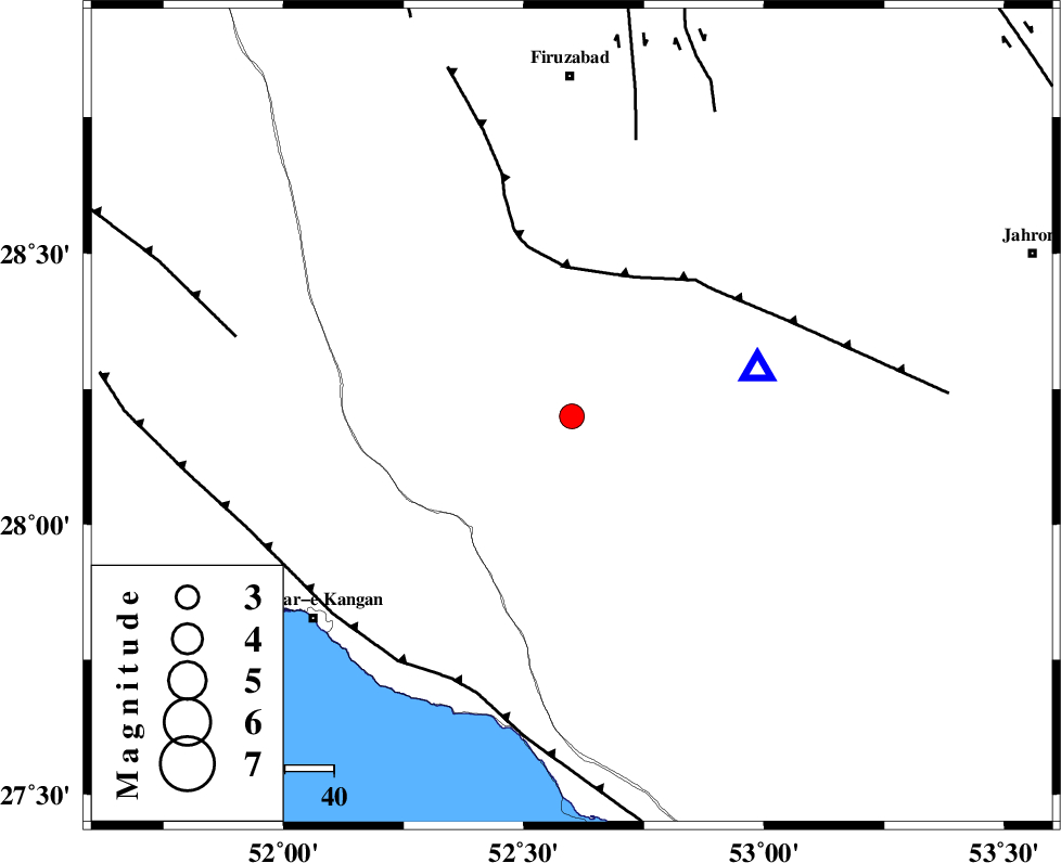
| Location | Lat:28.2 Lon: 52.6 |
| Region | Fars Province, 70 km South of Firuz Abad |
Nearest Cities |
|
| 19 km South of Hengam, Fars Province | |
| 25 km North West of Garmesht, Fars Province | |
| 31 km North East of Dolatabad, Fars Province | |
| 43 km South East of Dahrom, Fars Province | |
| 49 km North East of Jam, Bushehr Province | |
| Depth | 27 km |
| Agency | |
Faults within 150 km: |
|
| QIR_F (Length: 130 km) , Distance to epicenter: 31 km | |
| SABZ_PUSHAN_F_Z1 (Length: 69 km) , Distance to epicenter: 58 km | |
| MFF3 (Length: 292 km) , Distance to epicenter: 59 km | |
| Number of Phases | 5 |
| RMS | 0 |
| Number of Stations | 3 |
| Error in Latitude | >4.9 km |
| Error in Longitude | 5.6 km |
| Error in Depth | 2.2 km |
Download waveform in seisan format
to download seisan software Click here
to access information about IIEES stations Click here
Amplitude | ||||||||
| UID | Agency | Station | Component | Amplitude | Period | Arrival Time | Proccessing Time | Signal Clip |
| 77796 | IIEES | GHIR | N | 4654.3 | 0.36 | 2011-02-04 20:01:48 | 2011-02-04 08:27:00 | n |
| 77797 | IIEES | GHIR | E | 4536.4 | 0.32 | 2011-02-04 20:01:50 | 2011-02-04 08:27:00 | n |
| 77798 | IIEES | BNDS | E | 39.4 | 0.52 | 2011-02-04 20:03:30 | 2011-02-04 08:27:00 | n |
| 77799 | IIEES | BNDS | N | 45.7 | 0.68 | 2011-02-04 20:03:42 | 2011-02-04 08:27:00 | n |
| 77800 | IIEES | KRBR | N | 22.5 | 0.52 | 2011-02-04 20:03:54 | 2011-02-04 08:27:00 | n |
| 77801 | IIEES | KRBR | E | 24.8 | 0.64 | 2011-02-04 20:03:59 | 2011-02-04 08:27:00 | n |
Phase | ||||||||||||
| Agency | Station | Component | Phase Type | Phase Quality | First Motion | Observed Arrival Time | Time Residual | Loc. Flag | Input Weight | Distance | Azimuth | |
| IIEES | GHIR | Z | Pg | E | 2011-02-04 20:01:39 | 0 | y | 39.3 | 76 | |||
| IIEES | GHIR | E | Sg | E | 2011-02-04 20:01:45 | 0 | y | 39.3 | 76 | |||
| IIEES | BNDS | N | Pn | E | 2011-02-04 20:02:23 | 0 | y | 363 | 103 | |||
| IIEES | KRBR | Z | Pn | E | 2011-02-04 20:02:34 | 0 | y | 451 | 63 | |||
| IIEES | KRBR | E | Sg | E | 2011-02-04 20:03:34 | 0 | y | 451 | 63 | |||