
Magnitude |
3.6 |
| Date & Time (UTC) | 2011-02-24 03:36:18.0 |
| Date & Time (Local) | 1389/12/5 07:06:18.0 |
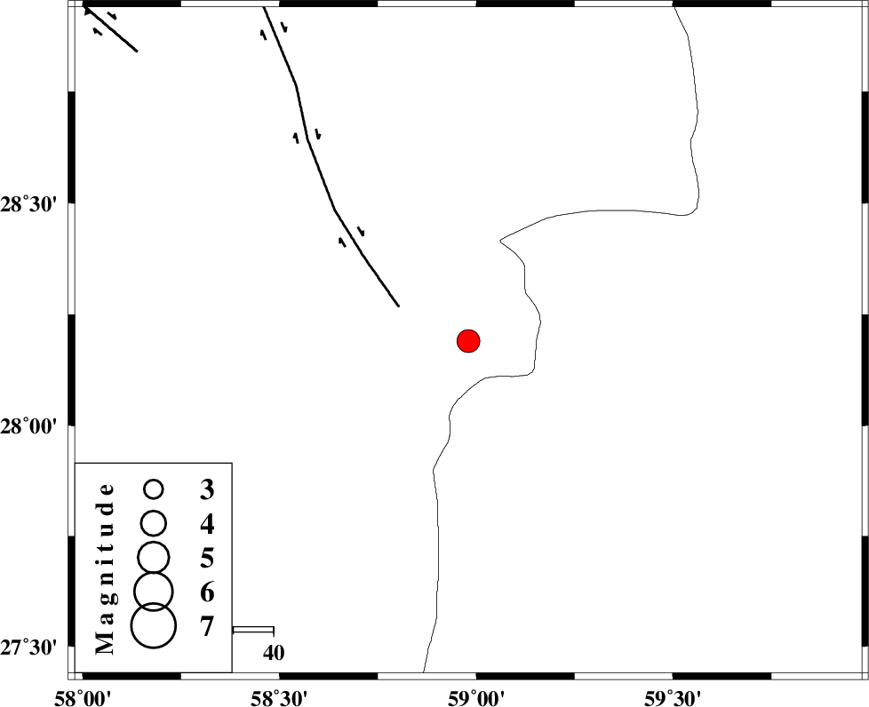
| Location | Lat:28.19 Lon: 58.98 |
| Region | Kerman Province, 129 km North-East of Kahnuj |
Nearest Cities |
|
| 49 km North East of Borj-e abbasabad, Kerman Province | |
| 58 km South of Hoseynabad, Kerman Province | |
| 59 km South East of Mohammadabad-e gonbaki, Kerman Province | |
| 76 km South of Void, Kerman Province | |
| 81 km South East of Mardehak, Kerman Province | |
| Depth | 18 km |
| Agency | |
Faults within 150 km: |
|
| BAM_F (Length: 118 km) , Distance to epicenter: 19 km | |
| KANURAK_F (Length: 135 km) , Distance to epicenter: 105 km | |
| GOWK_F (Length: 152 km) , Distance to epicenter: 109 km | |
| Number of Phases | 5 |
| RMS | 0.1 |
| Number of Stations | 3 |
| Error in Latitude | >2 km |
| Error in Longitude | 2.9 km |
| Error in Depth | 5.9 km |
Download waveform in seisan format
to download seisan software Click here
to access information about IIEES stations Click here
Amplitude | ||||||||
| UID | Agency | Station | Component | Amplitude | Period | Arrival Time | Proccessing Time | Signal Clip |
| 78087 | IIEES | BNDS | E | 254.6 | 0.44 | 2011-02-24 03:37:42 | 2011-02-24 03:49:00 | n |
| 78088 | IIEES | BNDS | N | 198.1 | 0.52 | 2011-02-24 03:37:42 | 2011-02-24 03:49:00 | n |
| 78089 | IIEES | KRBR | N | 281.3 | 0.52 | 2011-02-24 03:37:47 | 2011-02-24 03:49:00 | n |
| 78090 | IIEES | KRBR | E | 231.9 | 0.72 | 2011-02-24 03:37:50 | 2011-02-24 03:49:00 | n |
Phase | ||||||||||||
| Agency | Station | Component | Phase Type | Phase Quality | First Motion | Observed Arrival Time | Time Residual | Loc. Flag | Input Weight | Distance | Azimuth | |
| IIEES | ZHSF | Z | P | E | 2011-02-24 03:36:54 | 0.1 | y | 236 | 48 | |||
| IIEES | BNDS | Z | P | E | 2011-02-24 03:37:01 | 0 | y | 290 | 253 | |||
| IIEES | BNDS | E | Sg | E | 2011-02-24 03:37:39 | 0 | y | 290 | 253 | |||
| IIEES | KRBR | Z | P | E | 2011-02-24 03:37:01 | -0.1 | y | 293 | 313 | |||
| IIEES | KRBR | N | Sg | E | 2011-02-24 03:37:40 | 0 | y | 293 | 313 | |||