
Magnitude |
5.1 |
| Date & Time (UTC) | 2011-03-05 11:24:43.9 |
| Date & Time (Local) | 1389/12/14 14:54:43.9 |
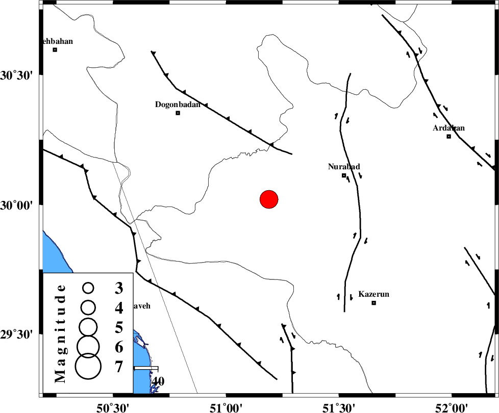
| Location | Lat:30.02 Lon: 51.19 |
| Region | Fars Province, 33 km West of Nurabad |
Nearest Cities |
|
| 5 km of Babamonir, Fars Province | |
| 25 km South West of Ahangari, Fars Province | |
| 32 km South West of Fahlian-e olia, Fars Province | |
| 34 km West of Nurabad, Fars Province | |
| 34 km West of Gachgaran, Fars Province | |
| Depth | 15 km |
| Agency | |
Faults within 150 km: |
|
| MISHAN_F (Length: 76 km) , Distance to epicenter: 22 km | |
| KAZERUN_F (Length: 96 km) , Distance to epicenter: 38 km | |
| BORAZJAN_F (Length: 168 km) , Distance to epicenter: 54 km | |
| Number of Phases | 6 |
| RMS | 0.4 |
| Number of Stations | 6 |
| Error in Latitude | >6.9 km |
| Error in Longitude | 4.2 km |
| Error in Depth | 0 km |
Download waveform in seisan format
to download seisan software Click here
to access information about IIEES stations Click here
Amplitude | ||||||||
| UID | Agency | Station | Component | Amplitude | Period | Arrival Time | Proccessing Time | Signal Clip |
| 78233 | IIEES | GHIR | E | 9401.5 | 0.37 | 2011-03-05 11:26:08 | 2011-03-05 11:38:00 | n |
| 78234 | IIEES | GHIR | N | 11549 | 0.72 | 2011-03-05 11:26:12 | 2011-03-05 11:38:00 | n |
| 78235 | IIEES | BNDS | E | 1008.8 | 0.66 | 2011-03-05 11:27:18 | 2011-03-05 11:38:00 | n |
| 78236 | IIEES | BNDS | N | 989.3 | 0.41 | 2011-03-05 11:27:22 | 2011-03-05 11:38:00 | n |
Phase | ||||||||||||
| Agency | Station | Component | Phase Type | Phase Quality | First Motion | Observed Arrival Time | Time Residual | Loc. Flag | Input Weight | Distance | Azimuth | |
| IIEES | GHIR | Z | Pn | E | 2011-03-05 11:25:24 | 0.4 | y | 260 | 137 | |||
| IIEES | SHGR | Z | Pn | E | 2011-03-05 11:25:31 | -0.2 | y | 325 | 316 | |||
| IIEES | NASN | Z | Pn | E | 2011-03-05 11:25:34 | -0.2 | y | 344 | 26 | |||
| IIEES | KHMZ | Z | Pn | E | 2011-03-05 11:25:45 | 0.3 | y | 428 | 345 | |||
| IIEES | BNDS | Z | Pn | E | 2011-03-05 11:26:01 | -0.8 | y | 567 | 120 | |||
| IIEES | TABS | Z | Pn | E | 2011-03-05 11:26:17 | 0.4 | y | 690 | 53 | |||