
Magnitude |
3.8 |
| Date & Time (UTC) | 2011-04-07 01:27:48.2 |
| Date & Time (Local) | 1390/1/18 05:57:48.2 |
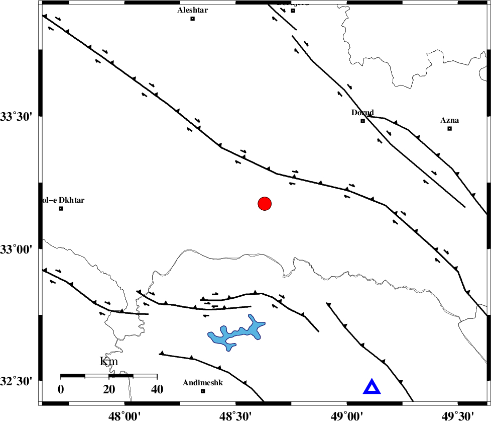
| Location | Lat:33.17 Lon: 48.63 |
| Region | Lorestan Province, 43 km South-East of Khorramabad |
Nearest Cities |
|
| 17 km West of Chamsangar, Lorestan Province | |
| 24 km South of Emanabad, Lorestan Province | |
| 32 km North West of Bargsar, Lorestan Province | |
| 33 km South West of Sartang barzeh, Lorestan Province | |
| 35 km South East of Daraei, Lorestan Province | |
| Depth | 18 km |
| Agency | |
Faults within 150 km: |
|
| HZF4 (Length: 492 km) , Distance to epicenter: 14 km | |
| BALARUD_F_Z2 (Length: 58 km) , Distance to epicenter: 38 km | |
| BALARUD_F_Z3 (Length: 53 km) , Distance to epicenter: 44 km | |
| Number of Phases | 5 |
| RMS | 0 |
| Number of Stations | 6 |
| Error in Latitude | >1.7 km |
| Error in Longitude | 6.3 km |
| Error in Depth | 3.7 km |
Download waveform in seisan format
to download seisan software Click here
to access information about IIEES stations Click here
Amplitude | ||||||||
| UID | Agency | Station | Component | Amplitude | Period | Arrival Time | Proccessing Time | Signal Clip |
| 78585 | IIEES | SNGE | N | 720 | 0.64 | 2011-04-07 01:29:07 | 2011-04-07 02:06:00 | n |
| 78586 | IIEES | GHVR | N | 440.5 | 0.64 | 2011-04-07 01:29:21 | 2011-04-07 02:06:00 | n |
| 78587 | IIEES | DAMV | E | 120.7 | 0.56 | 2011-04-07 01:29:50 | 2011-04-07 02:06:00 | n |
| 78588 | IIEES | DAMV | N | 120 | 0.76 | 2011-04-07 01:29:54 | 2011-04-07 02:06:00 | n |
Phase | ||||||||||||
| Agency | Station | Component | Phase Type | Phase Quality | First Motion | Observed Arrival Time | Time Residual | Loc. Flag | Input Weight | Distance | Azimuth | |
| IIEES | SHGR | Z | P | E | 2011-04-07 01:28:07 | 0 | y | 119 | 172 | |||
| IIEES | SHGR | E | Sg | E | 2011-04-07 01:28:22 | 0 | y | 119 | 172 | |||
| IIEES | ASAO | Z | P | E | 2011-04-07 01:28:20 | 0 | y | 200 | 40 | |||
| IIEES | ASAO | N | Sg | E | 2011-04-07 01:28:45 | 0 | y | 200 | 40 | |||
| IIEES | NASN | Z | P | E | 2011-04-07 01:28:44 | 0 | y | 393 | 95 | |||