
Magnitude |
3.3 |
| Date & Time (UTC) | 2011-07-08 07:21:27.4 |
| Date & Time (Local) | 1390/4/17 11:51:27.4 |
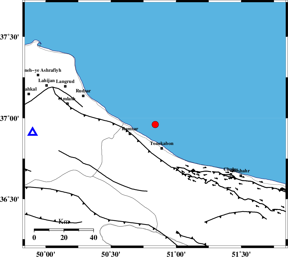
| Location | Lat:36.96 Lon: 50.84 |
| Region | Caspian Sea, 17 km North of Tonekabon |
Nearest Cities |
|
| 17 km North of Tonekabon, Mazandaran Province | |
| 18 km North of Soleymanabad, Mazandaran Province | |
| 18 km North East of Ramsar, Mazandaran Province | |
| 19 km North East of Galesh mahalleh, Mazandaran Province | |
| 20 km North of Khorramabad, Mazandaran Province | |
| Depth | 7 km |
| Agency | |
Faults within 150 km: |
|
| KHAZAR_F (Length: 523 km) , Distance to epicenter: 17 km | |
| N_ALBORZ_F (Length: 360 km) , Distance to epicenter: 31 km | |
| BONAN_F (Length: 74 km) , Distance to epicenter: 46 km | |
| Number of Phases | 7 |
| RMS | 0.1 |
| Number of Stations | 7 |
| Error in Latitude | >4.1 km |
| Error in Longitude | 5 km |
| Error in Depth | 3.7 km |
Download waveform in seisan format
to download seisan software Click here
to access information about IIEES stations Click here
Amplitude | ||||||||
| UID | Agency | Station | Component | Amplitude | Period | Arrival Time | Proccessing Time | Signal Clip |
| 79567 | IIEES | GHVR | E | 142.7 | 0.36 | 2011-07-08 07:22:53 | 2011-07-08 07:59:00 | n |
| 79568 | IIEES | ASAO | N | 201.5 | 0.32 | 2011-07-08 07:22:44 | 2011-07-08 07:59:00 | n |
| 79569 | IIEES | KHMZ | E | 51.4 | 0.32 | 2011-07-08 07:23:21 | 2011-07-08 07:59:00 | n |
| 79570 | IIEES | KHMZ | N | 55.4 | 0.48 | 2011-07-08 07:23:22 | 2011-07-08 07:59:00 | n |
Phase | ||||||||||||
| Agency | Station | Component | Phase Type | Phase Quality | First Motion | Observed Arrival Time | Time Residual | Loc. Flag | Input Weight | Distance | Azimuth | |
| IIEES | THKV | Z | Pg | E | 2011-07-08 07:21:47 | -0.17 | y | 116 | 178 | |||
| IIEES | CHTH | Z | Pg | E | 2011-07-08 07:21:48 | 0.13 | y | 119 | 168 | |||
| IIEES | CHTH | E | Sg | E | 2011-07-08 07:22:03 | 0.03 | y | 119 | 168 | |||
| IIEES | GHVR | Z | Pn | E | 2011-07-08 07:22:10 | -0.01 | y | 277 | 172 | |||
| IIEES | ASAO | Z | Pn | E | 2011-07-08 07:22:10 | -0.04 | y | 278 | 196 | |||
| IIEES | SNGE | Z | Pn | E | 2011-07-08 07:22:23 | 0.08 | y | 377 | 238 | |||
| IIEES | NASN | Z | Pn | E | 2011-07-08 07:22:37 | -0.02 | y | 495 | 158 | |||