
Magnitude |
3.5 |
| Date & Time (UTC) | 2011-07-17 11:59:04.0 |
| Date & Time (Local) | 1390/4/26 16:29:04.0 |
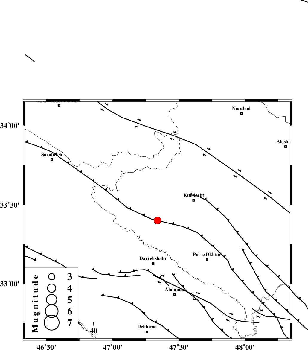
| Location | Lat:33.4 Lon: 47.34 |
| Region | Lorestan Province, 30 km North of Darreh Shahr |
Nearest Cities |
|
| 0 km of Kunani, Lorestan Province | |
| 11 km of Garab, Lorestan Province | |
| 12 km North West of Suri, Lorestan Province | |
| 17 km West of Ashtarheh golgol, Lorestan Province | |
| 18 km North West of Chaqabol, Lorestan Province | |
| Depth | 16 km |
| Agency | |
Faults within 150 km: |
|
| BALARUD_F_Z1 (Length: 87 km) , Distance to epicenter: 39 km | |
| HZF4 (Length: 492 km) , Distance to epicenter: 60 km | |
| MFF6 (Length: 144 km) , Distance to epicenter: 71 km | |
| Number of Phases | 7 |
| RMS | 0.1 |
| Number of Stations | 5 |
| Error in Latitude | >2.5 km |
| Error in Longitude | 3.1 km |
| Error in Depth | 5.1 km |
Download waveform in seisan format
to download seisan software Click here
to access information about IIEES stations Click here
Amplitude | ||||||||
| UID | Agency | Station | Component | Amplitude | Period | Arrival Time | Proccessing Time | Signal Clip |
| 79693 | IIEES | SNGE | N | 513.5 | 0.4 | 2011-07-17 12:00:02 | 2011-07-17 12:22:00 | n |
| 79694 | IIEES | SNGE | E | 716.1 | 0.48 | 2011-07-17 12:00:04 | 2011-07-17 12:22:00 | n |
| 79695 | IIEES | SHGR | E | 340.8 | 0.64 | 2011-07-17 12:00:12 | 2011-07-17 12:22:00 | n |
| 79696 | IIEES | SHGR | N | 305.6 | 0.52 | 2011-07-17 12:00:16 | 2011-07-17 12:22:00 | n |
Phase | ||||||||||||
| Agency | Station | Component | Phase Type | Phase Quality | First Motion | Observed Arrival Time | Time Residual | Loc. Flag | Input Weight | Distance | Azimuth | |
| IIEES | SNGE | Z | Pn | E | 2011-07-17 11:59:34 | -0.11 | y | 188 | 0 | |||
| IIEES | SNGE | E | Sg | E | 2011-07-17 11:59:57 | 0.05 | y | 188 | 0 | |||
| IIEES | SHGR | Z | Pn | E | 2011-07-17 11:59:36 | 0 | y | 198 | 136 | |||
| IIEES | KHMZ | Z | Pn | E | 2011-07-17 11:59:42 | 0.09 | y | 247 | 80 | |||
| IIEES | KHMZ | N | Sg | E | 2011-07-17 12:00:13 | -0.05 | y | 247 | 80 | |||
| IIEES | GHVR | Z | P | E | 2011-07-17 11:59:58 | 0.1 | y | 381 | 71 | |||
| IIEES | DAMV | Z | Pn | E | 2011-07-17 12:00:12 | -0.08 | y | 492 | 59 | |||