
Magnitude |
3.5 |
| Date & Time (UTC) | 2011-07-24 02:33:23.5 |
| Date & Time (Local) | 1390/5/2 07:03:23.5 |
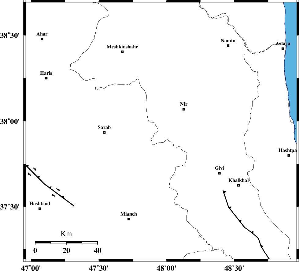
| Location | Lat:37.94 Lon: 47.96 |
| Region | Ardebil Province, 21 km South-West of Nir |
Nearest Cities |
|
| 9 km of Qarehshiran, Ardebil Province | |
| 15 km East of Kalian, Azarbaijan Sharghi Province | |
| 19 km North of Armodaq, Azarbaijan Sharghi Province | |
| 21 km South West of Nir, Ardebil Province | |
| 23 km South of Eslamabad, Ardebil Province | |
| Depth | 15 km |
| Agency | |
Faults within 150 km: |
|
| BOZQUSH (Length: 70 km) , Distance to epicenter: 6 km | |
| SANGAVAR_F (Length: 61 km) , Distance to epicenter: 37 km | |
| MASULEL_F (Length: 90 km) , Distance to epicenter: 56 km | |
| Number of Phases | 4 |
| RMS | 0 |
| Number of Stations | 4 |
| Error in Latitude | >2.2 km |
| Error in Longitude | 4.4 km |
| Error in Depth | 5.8 km |
Download waveform in seisan format
to download seisan software Click here
to access information about IIEES stations Click here
Amplitude | ||||||||
| UID | Agency | Station | Component | Amplitude | Period | Arrival Time | Proccessing Time | Signal Clip |
| 79764 | IIEES | ZNJK | E | 848.1 | 0.46 | 2011-07-24 02:34:15 | 2011-07-24 02:53:00 | n |
| 79765 | IIEES | THKV | E | 128.7 | 0 | 2011-07-24 02:35:00 | 2011-07-24 02:53:00 | n |
| 79766 | IIEES | THKV | N | 133.6 | 0.44 | 2011-07-24 02:35:02 | 2011-07-24 02:53:00 | n |
Phase | ||||||||||||
| Agency | Station | Component | Phase Type | Phase Quality | First Motion | Observed Arrival Time | Time Residual | Loc. Flag | Input Weight | Distance | Azimuth | |
| IIEES | ZNJK | Z | Pg | E | 2011-07-24 02:33:49 | -0.01 | y | 154 | 155 | |||
| IIEES | SNGE | Z | Pn | E | 2011-07-24 02:34:11 | 0 | y | 320 | 190 | |||
| IIEES | SNGE | E | Sg | E | 2011-07-24 02:34:53 | 0 | y | 320 | 190 | |||
| IIEES | MAKU | Z | Pn | E | 2011-07-24 02:34:11 | 0 | y | 326 | 300 | |||