
Magnitude |
3.1 |
| Date & Time (UTC) | 2011-08-18 02:24:03.0 |
| Date & Time (Local) | 1390/5/27 06:54:03.0 |
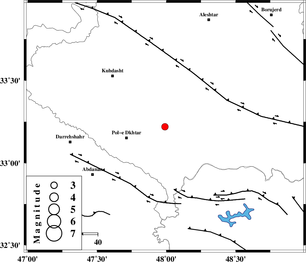
| Location | Lat:33.22 Lon: 47.99 |
| Region | Lorestan Province, 27 km East of Pol-e dokhtar |
Nearest Cities |
|
| 17 km South of Maeulan, Lorestan Province | |
| 25 km East of Morani, Lorestan Province | |
| 27 km North East of Pol-e dokhtar, Lorestan Province | |
| 27 km South West of Shoorab-e sofla, Lorestan Province | |
| 30 km South West of Godar-e mahmudvand, Lorestan Province | |
| Depth | 14 km |
| Agency | |
Faults within 150 km: |
|
| HZF4 (Length: 492 km) , Distance to epicenter: 41 km | |
| BALARUD_F_Z3 (Length: 53 km) , Distance to epicenter: 43 km | |
| BALARUD_F_Z1 (Length: 87 km) , Distance to epicenter: 45 km | |
| Number of Phases | 4 |
| RMS | 0.1 |
| Number of Stations | 3 |
| Error in Latitude | >2.5 km |
| Error in Longitude | 5.6 km |
| Error in Depth | 4.3 km |
Download waveform in seisan format
to download seisan software Click here
to access information about IIEES stations Click here
Amplitude | ||||||||
| UID | Agency | Station | Component | Amplitude | Period | Arrival Time | Proccessing Time | Signal Clip |
| 80010 | IIEES | SHGR | N | 514.5 | 0.28 | 2011-08-18 02:24:50 | 2011-08-18 02:48:00 | n |
| 80011 | IIEES | SHGR | E | 676 | 0.56 | 2011-08-18 02:24:51 | 2011-08-18 02:48:00 | n |
| 80012 | IIEES | GHVR | E | 43.4 | 0.56 | 2011-08-18 02:25:43 | 2011-08-18 02:48:00 | n |
| 80013 | IIEES | GHVR | N | 34.9 | 0.52 | 2011-08-18 02:25:48 | 2011-08-18 02:48:00 | n |
Phase | ||||||||||||
| Agency | Station | Component | Phase Type | Phase Quality | First Motion | Observed Arrival Time | Time Residual | Loc. Flag | Input Weight | Distance | Azimuth | |
| IIEES | SHGR | Z | Pg | E | 2011-08-18 02:24:26 | -0.05 | y | 145 | 148 | |||
| IIEES | SNGE | Z | Pn | E | 2011-08-18 02:24:37 | 0.11 | y | 216 | 344 | |||
| IIEES | SNGE | E | Sg | E | 2011-08-18 02:25:04 | -0.08 | y | 216 | 344 | |||
| IIEES | GHVR | Z | Pn | E | 2011-08-18 02:24:52 | 0.02 | y | 332 | 64 | |||