
Magnitude |
4.1 |
| Date & Time (UTC) | 2011-09-05 00:52:14.4 |
| Date & Time (Local) | 1390/6/14 05:22:14.4 |
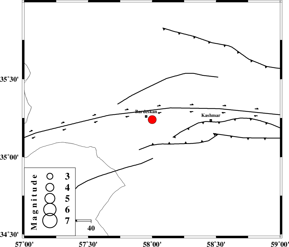
| Location | Lat:35.24 Lon: 58 |
| Region | Khorasan(center) Province, 5 km Bardeskan |
Nearest Cities |
|
| 5 km of Bardeskan, Khorasan(center) Province | |
| 13 km North West of Konder, Khorasan(center) Province | |
| 13 km North of Shahrabad, Khorasan(center) Province | |
| 15 km South of Kabudan, Khorasan(center) Province | |
| 28 km West of Khalilabad, Khorasan(center) Province | |
| Depth | 18 km |
| Agency | |
Faults within 150 km: |
|
| DORUNEH_F (Length: 713 km) , Distance to epicenter: 14 km | |
| MEHDIABAD_F (Length: 64 km) , Distance to epicenter: 18 km | |
| KASHMAR_F (Length: 91 km) , Distance to epicenter: 19 km | |
| Number of Phases | 6 |
| RMS | 0.1 |
| Number of Stations | 4 |
| Error in Latitude | >4.4 km |
| Error in Longitude | 1.5 km |
| Error in Depth | 6.5 km |
Download waveform in seisan format
to download seisan software Click here
to access information about IIEES stations Click here
Amplitude | ||||||||
| UID | Agency | Station | Component | Amplitude | Period | Arrival Time | Proccessing Time | Signal Clip |
| 80175 | IIEES | TABS | N | 1653.3 | 0.6 | 2011-09-05 00:53:26 | 2011-09-05 01:31:00 | n |
| 80176 | IIEES | SHRT | E | 996.2 | 0.44 | 2011-09-05 00:53:35 | 2011-09-05 01:31:00 | n |
| 80177 | IIEES | SHRT | N | 949.6 | 0.4 | 2011-09-05 00:53:41 | 2011-09-05 01:31:00 | n |
| 80178 | IIEES | NASN | N | 176.5 | 0.92 | 2011-09-05 00:55:04 | 2011-09-05 01:31:00 | n |
Phase | ||||||||||||
| Agency | Station | Component | Phase Type | Phase Quality | First Motion | Observed Arrival Time | Time Residual | Loc. Flag | Input Weight | Distance | Azimuth | |
| IIEES | TABS | Z | Pg | E | 2011-09-05 00:52:46 | 0.16 | y | 195 | 205 | |||
| IIEES | TABS | N | Sg | E | 2011-09-05 00:53:09 | -0.06 | y | 195 | 205 | |||
| IIEES | SHRT | Z | P | E | 2011-09-05 00:52:55 | -0.02 | y | 275 | 129 | |||
| IIEES | SHRT | N | Sg | E | 2011-09-05 00:53:31 | -0.01 | y | 275 | 129 | |||
| IIEES | NASN | Z | P | E | 2011-09-05 00:53:30 | -0.17 | y | 551 | 242 | |||
| IIEES | GHVR | Z | P | E | 2011-09-05 00:53:39 | 0.06 | y | 624 | 264 | |||