
Magnitude |
3.3 |
| Date & Time (UTC) | 2011-09-10 14:36:18.1 |
| Date & Time (Local) | 1390/6/19 19:06:18.1 |
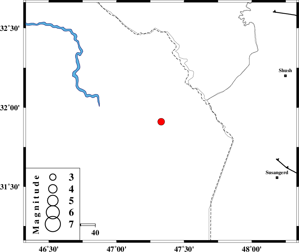
| Location | Lat:31.91 Lon: 47.33 |
| Region | Iraq, 88 km South of Dehloran |
Nearest Cities |
|
| 65 km North West of Bostan, Khoozestan Province | |
| 71 km South of Musian, Ilam Province | |
| 86 km North West of Hoveizeh, Khoozestan Province | |
| 87 km South of Dehloran, Ilam Province | |
| 90 km North West of Susangerd, Khoozestan Province | |
| Depth | 37 km |
| Agency | |
Faults within 150 km: |
|
| AHVAZ_F (Length: 99 km) , Distance to epicenter: 84 km | |
| MFF6 (Length: 144 km) , Distance to epicenter: 86 km | |
| DEZFUL_EMBAYMENT (Length: 228 km) , Distance to epicenter: 109 km | |
| Number of Phases | 5 |
| RMS | 0.1 |
| Number of Stations | 4 |
| Error in Latitude | >10.6 km |
| Error in Longitude | 5 km |
| Error in Depth | 6.9 km |
Download waveform in seisan format
to download seisan software Click here
to access information about IIEES stations Click here
Amplitude | ||||||||
| UID | Agency | Station | Component | Amplitude | Period | Arrival Time | Proccessing Time | Signal Clip |
| 80212 | IIEES | SHGR | N | 1536 | 0.31 | 2011-09-10 14:37:01 | 2011-09-10 03:05:00 | n |
| 80213 | IIEES | SHGR | E | 1419.7 | 0.37 | 2011-09-10 14:37:01 | 2011-09-10 03:05:00 | n |
| 80214 | IIEES | KHMZ | N | 36.1 | 0.34 | 2011-09-10 14:37:54 | 2011-09-10 03:05:00 | n |
| 80215 | IIEES | SNGE | E | 67.7 | 0.89 | 2011-09-10 14:37:57 | 2011-09-10 03:05:00 | n |
| 80216 | IIEES | SNGE | N | 36.5 | 0.53 | 2011-09-10 14:37:59 | 2011-09-10 03:05:00 | n |
Phase | ||||||||||||
| Agency | Station | Component | Phase Type | Phase Quality | First Motion | Observed Arrival Time | Time Residual | Loc. Flag | Input Weight | Distance | Azimuth | |
| IIEES | SHGR | Z | Pg | E | 2011-09-10 14:36:41 | 0.02 | y | 141 | 80 | |||
| IIEES | SHGR | N | Sg | E | 2011-09-10 14:36:58 | -0.01 | y | 141 | 80 | |||
| IIEES | KHMZ | Z | Pn | E | 2011-09-10 14:37:03 | -0.11 | y | 320 | 50 | |||
| IIEES | SNGE | Z | Pn | E | 2011-09-10 14:37:07 | -0.04 | y | 354 | 0 | |||
| IIEES | ASAO | Z | Pn | E | 2011-09-10 14:37:11 | 0.16 | y | 386 | 40 | |||