
Magnitude |
2.8 |
| Date & Time (UTC) | 2011-10-20 11:28:41.2 |
| Date & Time (Local) | 1390/7/28 14:58:41.2 |
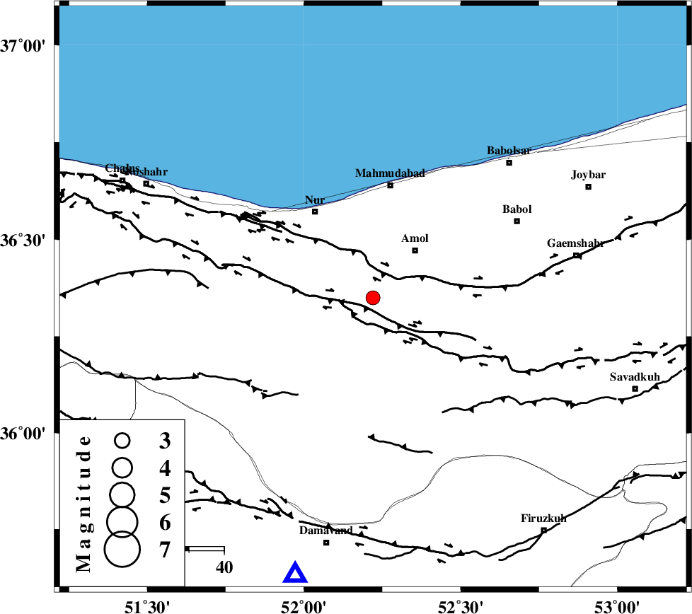
| Location | Lat:36.35 Lon: 52.22 |
| Region | Mazandaran Province, 18 km South-West of Amol |
Nearest Cities |
|
| 12 km West of Oskumahalleh, Mazandaran Province | |
| 13 km North West of Razkeh, Mazandaran Province | |
| 17 km South East of Chamestan, Mazandaran Province | |
| 18 km South West of Amol, Mazandaran Province | |
| 25 km North East of Pil, Mazandaran Province | |
| Depth | 14 km |
| Agency | |
Faults within 150 km: |
|
| N_ALBORZ_F (Length: 360 km) , Distance to epicenter: 6 km | |
| KHAZAR_F (Length: 523 km) , Distance to epicenter: 7 km | |
| KANDOVAN_F (Length: 90 km) , Distance to epicenter: 40 km | |
| Number of Phases | 5 |
| RMS | 0.1 |
| Number of Stations | 4 |
| Error in Latitude | >2.8 km |
| Error in Longitude | 4.8 km |
| Error in Depth | 7.8 km |
Download waveform in seisan format
to download seisan software Click here
to access information about IIEES stations Click here
Amplitude | ||||||||
| UID | Agency | Station | Component | Amplitude | Period | Arrival Time | Proccessing Time | Signal Clip |
| 80494 | IIEES | THKV | N | 179.8 | 0.44 | 2011-10-20 11:29:21 | 2011-10-20 11:53:00 | n |
| 80495 | IIEES | THKV | E | 172.2 | 0.28 | 2011-10-20 11:29:21 | 2011-10-20 11:53:00 | n |
Phase | ||||||||||||
| Agency | Station | Component | Phase Type | Phase Quality | First Motion | Observed Arrival Time | Time Residual | Loc. Flag | Input Weight | Distance | Azimuth | |
| IIEES | CHTH | Z | Pg | E | 2011-10-20 11:28:59 | -0.23 | y | 110 | 244 | |||
| IIEES | THKV | Z | Pg | E | 2011-10-20 11:29:03 | 0.22 | y | 130 | 248 | |||
| IIEES | GHVR | Z | Pn | E | 2011-10-20 11:29:16 | 0.03 | y | 226 | 203 | |||
| IIEES | GHVR | E | Sg | E | 2011-10-20 11:29:45 | 0 | y | 226 | 203 | |||
| IIEES | SHRO | N | Pn | E | 2011-10-20 11:29:31 | -0.02 | y | 344 | 95 | |||