
Magnitude |
2.6 |
| Date & Time (UTC) | 2011-11-25 21:39:39.4 |
| Date & Time (Local) | 1390/9/5 01:09:39.4 |
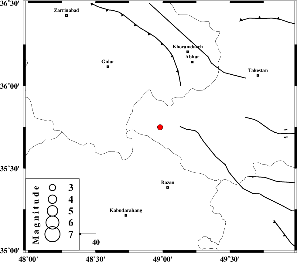
| Location | Lat:35.75 Lon: 48.98 |
| Region | Ghazvin Province, 41 km North of Razan |
Nearest Cities |
|
| 28 km West of Ab-e garm, Ghazvin Province | |
| 28 km North East of Kahla, Zanjan Province | |
| 29 km North West of Avaj, Ghazvin Province | |
| 31 km North East of Khorandeh, Hamedan Province | |
| 37 km North East of Damag, Hamedan Province | |
| Depth | 14 km |
| Agency | |
Faults within 150 km: |
|
| KUSHK_E_NOSRAT_F (Length: 230 km) , Distance to epicenter: 13 km | |
| SOLTANIYEH_F (Length: 119 km) , Distance to epicenter: 31 km | |
| ZANJAN_F (Length: 137 km) , Distance to epicenter: 55 km | |
| Number of Phases | 7 |
| RMS | 0.2 |
| Number of Stations | 5 |
| Error in Latitude | >1.6 km |
| Error in Longitude | 2 km |
| Error in Depth | 17.9 km |
Download waveform in seisan format
to download seisan software Click here
to access information about IIEES stations Click here
Amplitude | ||||||||
| UID | Agency | Station | Component | Amplitude | Period | Arrival Time | Proccessing Time | Signal Clip |
| 80798 | IIEES | SNGE | N | 96.2 | 0.32 | 2011-11-25 21:40:28 | 2011-11-25 09:01:00 | n |
| 80799 | IIEES | SNGE | E | 61.5 | 0.48 | 2011-11-25 21:40:28 | 2011-11-25 09:01:00 | n |
Phase | ||||||||||||
| Agency | Station | Component | Phase Type | Phase Quality | First Motion | Observed Arrival Time | Time Residual | Loc. Flag | Input Weight | Distance | Azimuth | |
| IIEES | ZNJK | Z | P | E | 2011-11-25 21:39:57 | 0.17 | y | 105 | 346 | |||
| IIEES | ZNJK | E | Sg | E | 2011-11-25 21:40:10 | -0.23 | y | 105 | 346 | |||
| IIEES | ASAO | Z | Pg | E | 2011-11-25 21:40:06 | -0.16 | y | 164 | 144 | |||
| IIEES | ASAO | E | Sg | E | 2011-11-25 21:40:26 | -0.13 | y | 164 | 144 | |||
| IIEES | SNGE | Z | Pg | E | 2011-11-25 21:40:07 | 0.29 | y | 165 | 244 | |||
| IIEES | SNGE | N | Sg | E | 2011-11-25 21:40:26 | -0.16 | y | 165 | 244 | |||
| IIEES | GHVR | Z | Pg | E | 2011-11-25 21:40:20 | 0.22 | y | 250 | 124 | |||