
Magnitude |
3.5 |
| Date & Time (UTC) | 2011-12-14 15:56:46.7 |
| Date & Time (Local) | 1390/9/23 19:26:46.7 |
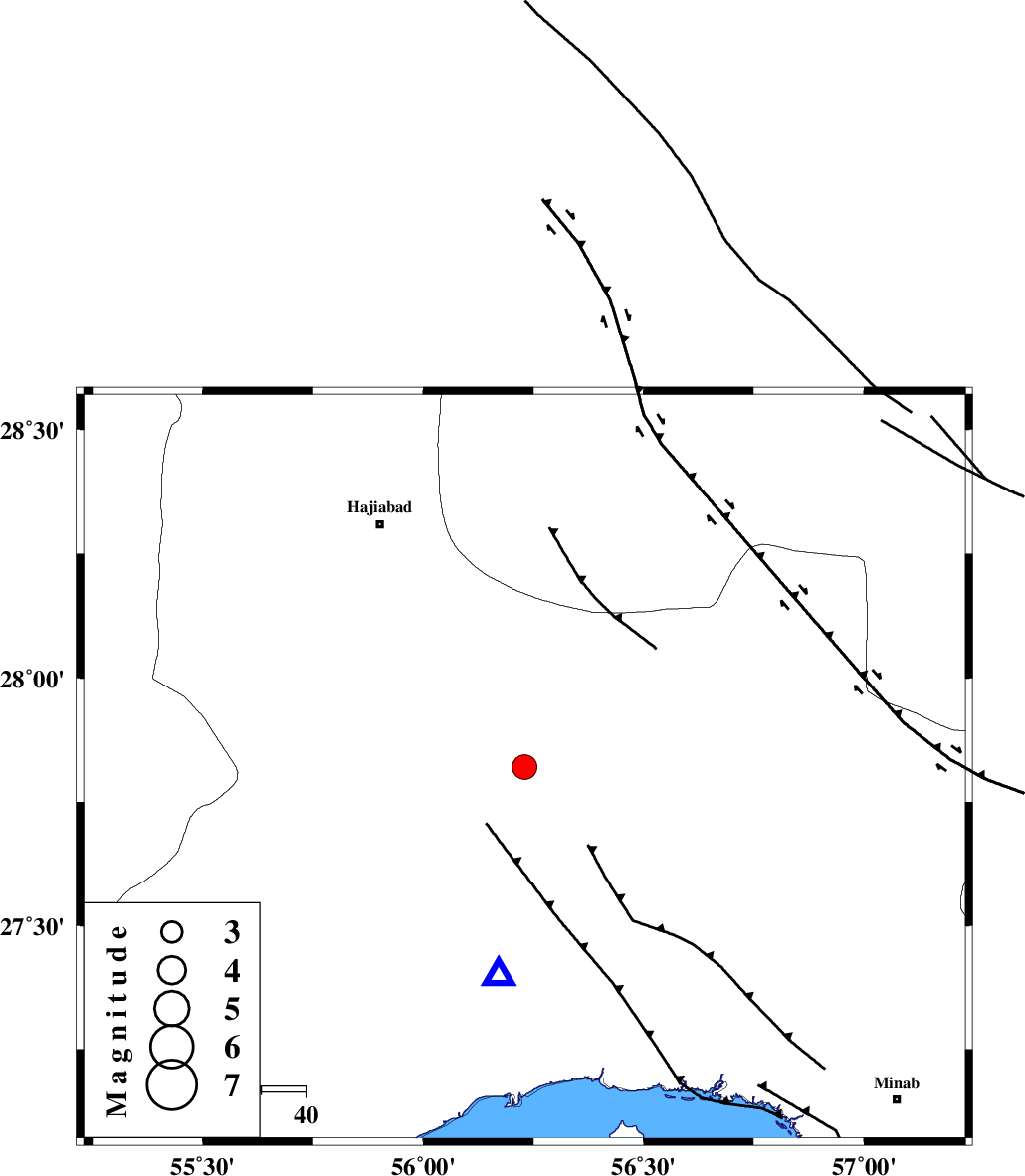
| Location | Lat:27.82 Lon: 56.23 |
| Region | Hormozgan Province, 71 km North of Bandar-e abbas |
Nearest Cities |
|
| 22 km South of Fareqan, Hormozgan Province | |
| 38 km North East of Fin, Hormozgan Province | |
| 63 km South East of Hajiabad, Hormozgan Province | |
| 70 km South West of Arzuieeh, Kerman Province | |
| 71 km North of Bandar-e abbas, Hormozgan Province | |
| Depth | 14 km |
| Agency | |
Faults within 150 km: |
|
| HZF2 (Length: 437 km) , Distance to epicenter: 3 km | |
| MAIN_ZAGROS_R_F (Length: 1106 km) , Distance to epicenter: 43 km | |
| ZENDAN_MINAB_F_Z1 (Length: 183 km) , Distance to epicenter: 74 km | |
| Number of Phases | 4 |
| RMS | 0.1 |
| Number of Stations | 3 |
| Error in Latitude | >1.9 km |
| Error in Longitude | 5.8 km |
| Error in Depth | 5.7 km |
Download waveform in seisan format
to download seisan software Click here
to access information about IIEES stations Click here
Amplitude | ||||||||
| UID | Agency | Station | Component | Amplitude | Period | Arrival Time | Proccessing Time | Signal Clip |
| 80999 | IIEES | KRBR | N | 448.1 | 0.44 | 2011-12-14 15:57:58 | 2011-12-14 03:22:00 | n |
| 81000 | IIEES | KRBR | E | 419.2 | 0.44 | 2011-12-14 15:57:59 | 2011-12-14 03:22:00 | n |
| 81001 | IIEES | GHIR | E | 125.9 | 0.6 | 2011-12-14 15:58:31 | 2011-12-14 03:22:00 | n |
| 81002 | IIEES | GHIR | N | 127.9 | 0.64 | 2011-12-14 15:58:37 | 2011-12-14 03:22:00 | n |
Phase | ||||||||||||
| Agency | Station | Component | Phase Type | Phase Quality | First Motion | Observed Arrival Time | Time Residual | Loc. Flag | Input Weight | Distance | Azimuth | |
| IIEES | BNDS | Z | Pg | E | 2011-12-14 15:56:55 | -0.04 | y | 46.7 | 187 | |||
| IIEES | KRBR | Z | Pn | E | 2011-12-14 15:57:25 | 0.2 | y | 245 | 12 | |||
| IIEES | KRBR | E | Sg | E | 2011-12-14 15:57:56 | -0.12 | y | 245 | 12 | |||
| IIEES | GHIR | Z | Pn | E | 2011-12-14 15:57:34 | -0.05 | y | 323 | 280 | |||