
Magnitude |
3.2 |
| Date & Time (UTC) | 2012-03-10 15:54:28.6 |
| Date & Time (Local) | 1390/12/20 19:24:28.6 |
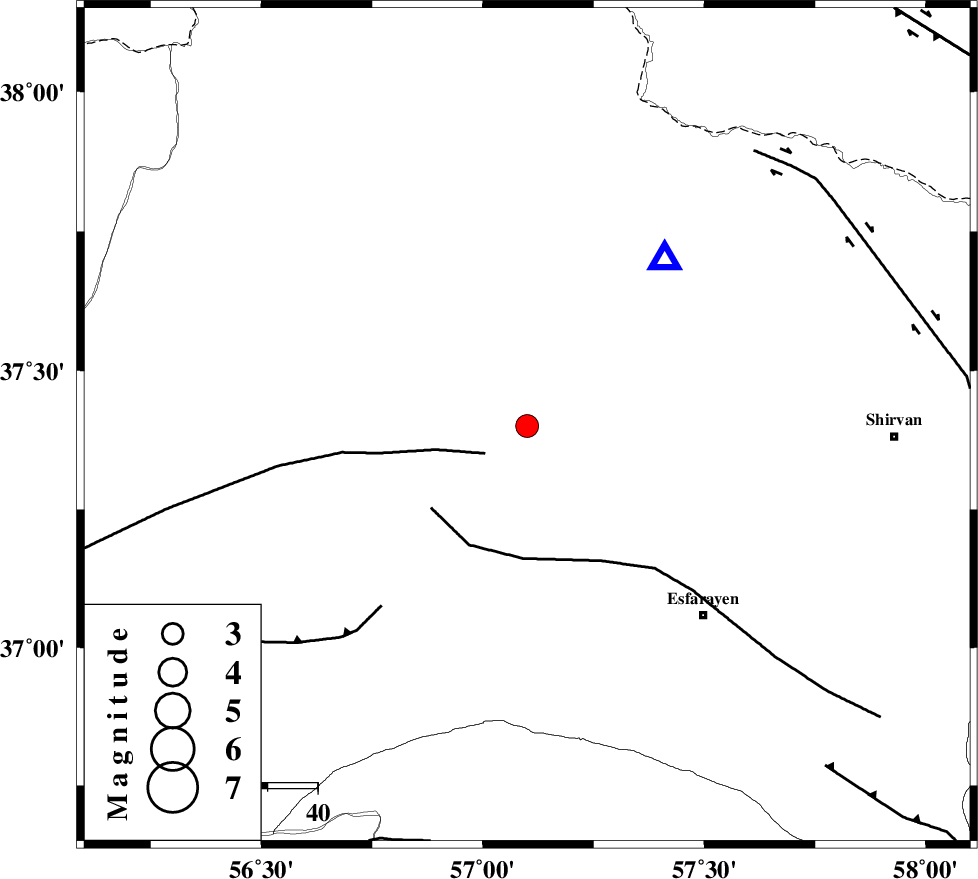
| Location | Lat:37.4 Lon: 57.1 |
| Region | Khorasan(north) Province, 22 km West of Bojnurd |
Nearest Cities |
|
| 22 km South East of Ashkhaneh, Khorasan(north) Province | |
| 22 km West of Void, Khorasan(north) Province | |
| 22 km West of Bojnurd, Khorasan(north) Province | |
| 24 km North East of Shogan, Khorasan(north) Province | |
| 29 km South of Pish qaleh, Khorasan(north) Province | |
| Depth | 15 km |
| Agency | |
Faults within 150 km: |
|
| ROBATE_QARABIL_F (Length: 168 km) , Distance to epicenter: 10 km | |
| ESFARAYEN_F (Length: 111 km) , Distance to epicenter: 25 km | |
| JAJARAM_F (Length: 77 km) , Distance to epicenter: 46 km | |
| Number of Phases | 3 |
| RMS | 0 |
| Number of Stations | 4 |
| Error in Latitude | >1.9 km |
| Error in Longitude | 2.4 km |
| Error in Depth | 0 km |
Download waveform in seisan format
to download seisan software Click here
to access information about IIEES stations Click here
Amplitude | ||||||||
| UID | Agency | Station | Component | Amplitude | Period | Arrival Time | Proccessing Time | Signal Clip |
| 82236 | IIEES | SHRO | N | 269.8 | 0.56 | 2012-03-10 15:55:24 | 2012-03-10 03:18:00 | n |
| 82237 | IIEES | TABS | N | 35.5 | 0.52 | 2012-03-10 15:56:35 | 2012-03-10 03:18:00 | n |
Phase | ||||||||||||
| Agency | Station | Component | Phase Type | Phase Quality | First Motion | Observed Arrival Time | Time Residual | Loc. Flag | Input Weight | Distance | Azimuth | |
| IIEES | BJRD | Z | Pg | E | 2012-03-10 15:54:36 | 0 | y | 43.4 | 39 | |||
| IIEES | MRVT | Z | Pg | E | 2012-03-10 15:54:44 | 0 | y | 93.8 | 288 | |||
| IIEES | SHRO | Z | Pg | E | 2012-03-10 15:54:58 | 0 | y | 182 | 213 | |||