
Magnitude |
3.1 |
| Date & Time (UTC) | 2012-04-18 20:46:01.4 |
| Date & Time (Local) | 1391/1/31 01:16:01.4 |
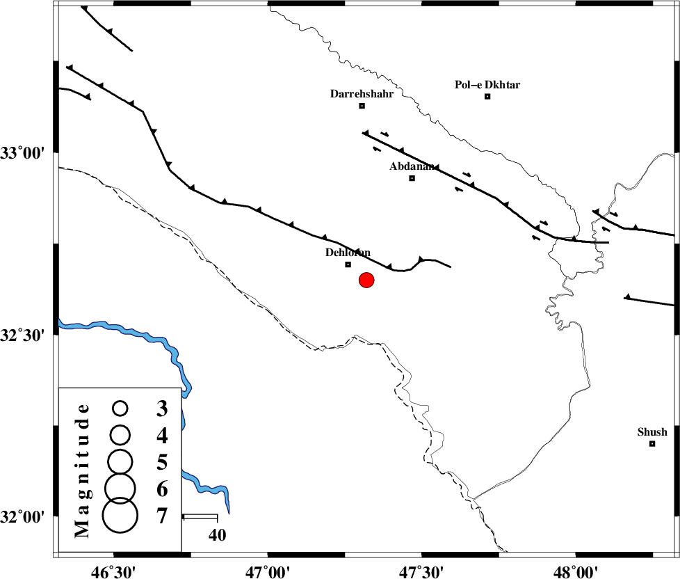
| Location | Lat:32.65 Lon: 47.32 |
| Region | Ilam Province, 8 km Dehloran |
Nearest Cities |
|
| 7 km of Dehloran, Ilam Province | |
| 12 km North of Musian, Ilam Province | |
| 34 km South West of Abdanan, Ilam Province | |
| 36 km South West of Sarabbagh, Ilam Province | |
| 38 km South East of Bishehzar, Ilam Province | |
| Depth | 18 km |
| Agency | |
Faults within 150 km: |
|
| MFF6 (Length: 144 km) , Distance to epicenter: 6 km | |
| BALARUD_F_Z1 (Length: 87 km) , Distance to epicenter: 45 km | |
| BALARUD_F_Z3 (Length: 53 km) , Distance to epicenter: 72 km | |
| Number of Phases | 4 |
| RMS | 0.1 |
| Number of Stations | 3 |
| Error in Latitude | >3.1 km |
| Error in Longitude | 4.9 km |
| Error in Depth | 7.5 km |
Download waveform in seisan format
to download seisan software Click here
to access information about IIEES stations Click here
Amplitude | ||||||||
| UID | Agency | Station | Component | Amplitude | Period | Arrival Time | Proccessing Time | Signal Clip |
| 82820 | IIEES | SHGR | E | 350.4 | 0.76 | 2012-04-18 20:46:51 | 2012-04-18 09:24:00 | n |
| 82821 | IIEES | SHGR | N | 449.3 | 0.36 | 2012-04-18 20:46:52 | 2012-04-18 09:24:00 | n |
| 82822 | IIEES | SNGE | E | 41.6 | 0.68 | 2012-04-18 20:47:26 | 2012-04-18 09:24:00 | n |
Phase | ||||||||||||
| Agency | Station | Component | Phase Type | Phase Quality | First Motion | Observed Arrival Time | Time Residual | Loc. Flag | Input Weight | Distance | Azimuth | |
| IIEES | SHGR | Z | Pg | E | 2012-04-18 20:46:26 | 0.04 | y | 151 | 113 | |||
| IIEES | SNGE | Z | Pn | E | 2012-04-18 20:46:42 | 0.1 | y | 271 | 0 | |||
| IIEES | KHMZ | Z | Pn | E | 2012-04-18 20:46:42 | -0.15 | y | 274 | 63 | |||
| IIEES | KHMZ | N | Sg | E | 2012-04-18 20:47:18 | 0.01 | y | 274 | 63 | |||