
Magnitude |
3.1 |
| Date & Time (UTC) | 2012-04-23 01:49:41.1 |
| Date & Time (Local) | 1391/2/4 06:19:41.1 |
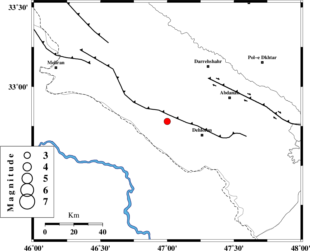
| Location | Lat:32.78 Lon: 47 |
| Region | Ilam Province, 26 km West of Dehloran |
Nearest Cities |
|
| 6 km of Bishehzar, Ilam Province | |
| 26 km North West of Dehloran, Ilam Province | |
| 43 km North West of Musian, Ilam Province | |
| 47 km South West of Abdanan, Ilam Province | |
| 48 km South West of Darreh Shahr, Ilam Province | |
| Depth | 15 km |
| Agency | |
Faults within 150 km: |
|
| MFF6 (Length: 144 km) , Distance to epicenter: 5 km | |
| BALARUD_F_Z1 (Length: 87 km) , Distance to epicenter: 42 km | |
| ZFF4 (Length: 128 km) , Distance to epicenter: 67 km | |
| Number of Phases | 5 |
| RMS | 0 |
| Number of Stations | 4 |
| Error in Latitude | >2.8 km |
| Error in Longitude | 3.9 km |
| Error in Depth | 5.9 km |
Download waveform in seisan format
to download seisan software Click here
to access information about IIEES stations Click here
Amplitude | ||||||||
| UID | Agency | Station | Component | Amplitude | Period | Arrival Time | Proccessing Time | Signal Clip |
| 83031 | IIEES | SHGR | E | 222.8 | 0.44 | 2012-04-23 01:50:37 | 2012-04-23 02:09:00 | n |
| 83032 | IIEES | SHGR | N | 169.1 | 0.48 | 2012-04-23 01:50:38 | 2012-04-23 02:09:00 | n |
Phase | ||||||||||||
| Agency | Station | Component | Phase Type | Phase Quality | First Motion | Observed Arrival Time | Time Residual | Loc. Flag | Input Weight | Distance | Azimuth | |
| IIEES | SHGR | Z | Pg | E | 2012-04-23 01:50:11 | 0 | y | 185 | 113 | |||
| IIEES | SNGE | Z | Pn | E | 2012-04-23 01:50:20 | -0.02 | y | 258 | 7 | |||
| IIEES | KHMZ | Z | Pn | E | 2012-04-23 01:50:25 | -0.06 | y | 296 | 68 | |||
| IIEES | KHMZ | E | Sg | E | 2012-04-23 01:51:04 | -0.01 | y | 296 | 68 | |||
| IIEES | ASAO | Z | Pn | E | 2012-04-23 01:50:31 | 0.09 | y | 342 | 54 | |||