
Magnitude |
2.8 |
| Date & Time (UTC) | 2012-04-23 03:02:55.4 |
| Date & Time (Local) | 1391/2/4 07:32:55.4 |
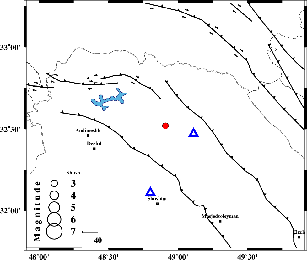
| Location | Lat:32.52 Lon: 48.91 |
| Region | Khoozestan Province, 24 km North-West of Lali |
Nearest Cities |
|
| 7 km North of Sardasht, Khoozestan Province | |
| 24 km North West of Lali, Khoozestan Province | |
| 27 km North East of Mahur berenji, Khoozestan Province | |
| 32 km North of Gatvand, Khoozestan Province | |
| 32 km South of Shuy, Khoozestan Province | |
| Depth | 41 km |
| Agency | |
Faults within 150 km: |
|
| BALARUD_F_Z2 (Length: 58 km) , Distance to epicenter: 19 km | |
| MFF2 (Length: 205 km) , Distance to epicenter: 19 km | |
| DEZFUL_EMBAYMENT (Length: 228 km) , Distance to epicenter: 24 km | |
| Number of Phases | 4 |
| RMS | 0 |
| Number of Stations | 3 |
| Error in Latitude | >2.7 km |
| Error in Longitude | 4.3 km |
| Error in Depth | 3 km |
Download waveform in seisan format
to download seisan software Click here
to access information about IIEES stations Click here
Amplitude | ||||||||
| UID | Agency | Station | Component | Amplitude | Period | Arrival Time | Proccessing Time | Signal Clip |
| 83044 | IIEES | SHGR | N | 597.3 | 0.32 | 2012-04-23 03:03:23 | 2012-04-23 03:34:00 | n |
| 83045 | IIEES | SHGR | E | 536.8 | 0.44 | 2012-04-23 03:03:26 | 2012-04-23 03:34:00 | n |
Phase | ||||||||||||
| Agency | Station | Component | Phase Type | Phase Quality | First Motion | Observed Arrival Time | Time Residual | Loc. Flag | Input Weight | Distance | Azimuth | |
| IIEES | SHGR | Z | Pg | E | 2012-04-23 03:03:05 | -0.01 | y | 47.1 | 193 | |||
| IIEES | KHMZ | Z | Pn | E | 2012-04-23 03:03:21 | 0 | y | 167 | 36 | |||
| IIEES | KHMZ | N | Sg | E | 2012-04-23 03:03:43 | 0 | y | 167 | 36 | |||
| IIEES | SNGE | Z | Pn | E | 2012-04-23 03:03:40 | 0.01 | y | 320 | 333 | |||