
Magnitude |
2.3 |
| Date & Time (UTC) | 2012-05-21 05:18:00.4 |
| Date & Time (Local) | 1391/3/1 09:48:00.4 |
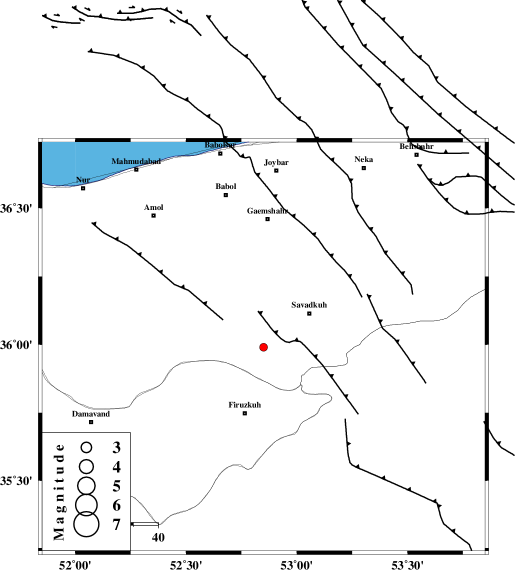
| Location | Lat:35.99 Lon: 52.85 |
| Region | Mazandaran Province, 28 km North of Firuzkuh |
Nearest Cities |
|
| 8 km of Alasht, Mazandaran Province | |
| 16 km South West of Elahband, Mazandaran Province | |
| 21 km South West of Shurmast-e peyrudbar, Mazandaran Province | |
| 23 km South West of Zirab, Mazandaran Province | |
| 23 km South West of Pol-E-Sefid, Mazandaran Province | |
| Depth | 14 km |
| Agency | |
Faults within 150 km: |
|
| N_ALBORZ_F (Length: 360 km) , Distance to epicenter: 22 km | |
| ATARI_F (Length: 185 km) , Distance to epicenter: 34 km | |
| MOSHA_F (Length: 234 km) , Distance to epicenter: 38 km | |
| Number of Phases | 6 |
| RMS | 0.2 |
| Number of Stations | 5 |
| Error in Latitude | >3.6 km |
| Error in Longitude | 5.1 km |
| Error in Depth | 8 km |
Download waveform in seisan format
to download seisan software Click here
to access information about IIEES stations Click here
Amplitude | ||||||||
| UID | Agency | Station | Component | Amplitude | Period | Arrival Time | Proccessing Time | Signal Clip |
| 83720 | IIEES | DAMV | E | 68.6 | 0.15 | 2012-05-21 05:18:31 | 2012-05-21 06:04:00 | n |
| 83721 | IIEES | GHVR | N | 32.4 | 0.25 | 2012-05-21 05:19:08 | 2012-05-21 06:04:00 | n |
Phase | ||||||||||||
| Agency | Station | Component | Phase Type | Phase Quality | First Motion | Observed Arrival Time | Time Residual | Loc. Flag | Input Weight | Distance | Azimuth | |
| IIEES | DAMV | Z | Pg | E | 2012-05-21 05:18:15 | -0.33 | y | 88.7 | 244 | |||
| IIEES | CHTH | Z | Pg | E | 2012-05-21 05:18:26 | 0.21 | y | 156 | 267 | |||
| IIEES | GHVR | Z | Pn | E | 2012-05-21 05:18:35 | -0.05 | y | 222 | 222 | |||
| IIEES | GHVR | N | Sg | E | 2012-05-21 05:19:03 | 0.12 | y | 222 | 222 | |||
| IIEES | SHRO | Z | Pn | E | 2012-05-21 05:18:43 | 0.04 | y | 285 | 89 | |||
| IIEES | NASN | Z | Pn | E | 2012-05-21 05:18:52 | 0.02 | y | 353 | 181 | |||