
Magnitude |
1.5 |
| Date & Time (UTC) | 2012-05-31 01:41:59.6 |
| Date & Time (Local) | 1391/3/11 06:11:59.6 |
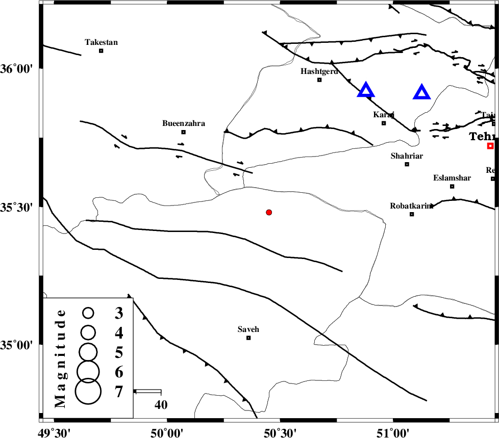
| Location | Lat:35.48 Lon: 50.45 |
| Region | Markazi Province, 52 km North of Saveh |
Nearest Cities |
|
| 14 km North East of Khoshkrud, Markazi Province | |
| 14 km North West of Zaviyeh, Markazi Province | |
| 16 km North of Hakimabad, Markazi Province | |
| 22 km North of Memunieh, Markazi Province | |
| 25 km North West of Rahimabad, Markazi Province | |
| Depth | 23 km |
| Agency | |
Faults within 150 km: |
|
| S_PARANDAK_F (Length: 116 km) , Distance to epicenter: 14 km | |
| IPAK_F (Length: 80 km) , Distance to epicenter: 17 km | |
| ESHTEHARD_F (Length: 69 km) , Distance to epicenter: 31 km | |
| Number of Phases | 7 |
| RMS | 0.1 |
| Number of Stations | 5 |
| Error in Latitude | >1.1 km |
| Error in Longitude | 2.3 km |
| Error in Depth | 3.9 km |
Download waveform in seisan format
to download seisan software Click here
to access information about IIEES stations Click here
Amplitude | ||||||||
| UID | Agency | Station | Component | Amplitude | Period | Arrival Time | Proccessing Time | Signal Clip |
| 83825 | IIEES | GHVR | N | 11.9 | 0.16 | 2012-05-31 01:42:38 | 2012-05-31 02:47:00 | n |
| 83826 | IIEES | GHVR | E | 8.5 | 0.2 | 2012-05-31 01:42:42 | 2012-05-31 02:47:00 | n |
Phase | ||||||||||||
| Agency | Station | Component | Phase Type | Phase Quality | First Motion | Observed Arrival Time | Time Residual | Loc. Flag | Input Weight | Distance | Azimuth | |
| IIEES | CHTH | Z | Pg | E | 2012-05-31 01:42:13 | 0.04 | y | 77 | 52 | |||
| IIEES | CHTH | E | Sg | E | 2012-05-31 01:42:22 | -0.1 | y | 77 | 52 | |||
| IIEES | ASAO | Z | Pg | E | 2012-05-31 01:42:18 | -0.02 | y | 111 | 201 | |||
| IIEES | GHVR | Z | Pg | E | 2012-05-31 01:42:21 | 0.04 | y | 133 | 147 | |||
| IIEES | GHVR | N | Sg | E | 2012-05-31 01:42:37 | -0.04 | y | 133 | 147 | |||
| IIEES | DAMV | Z | Pg | E | 2012-05-31 01:42:22 | 0.11 | y | 139 | 83 | |||
| IIEES | KHMZ | Z | Pn | E | 2012-05-31 01:42:31 | -0.03 | y | 199 | 193 | |||