
Magnitude |
2.9 |
| Date & Time (UTC) | 2012-06-09 19:20:20.4 |
| Date & Time (Local) | 1391/3/20 23:50:20.4 |
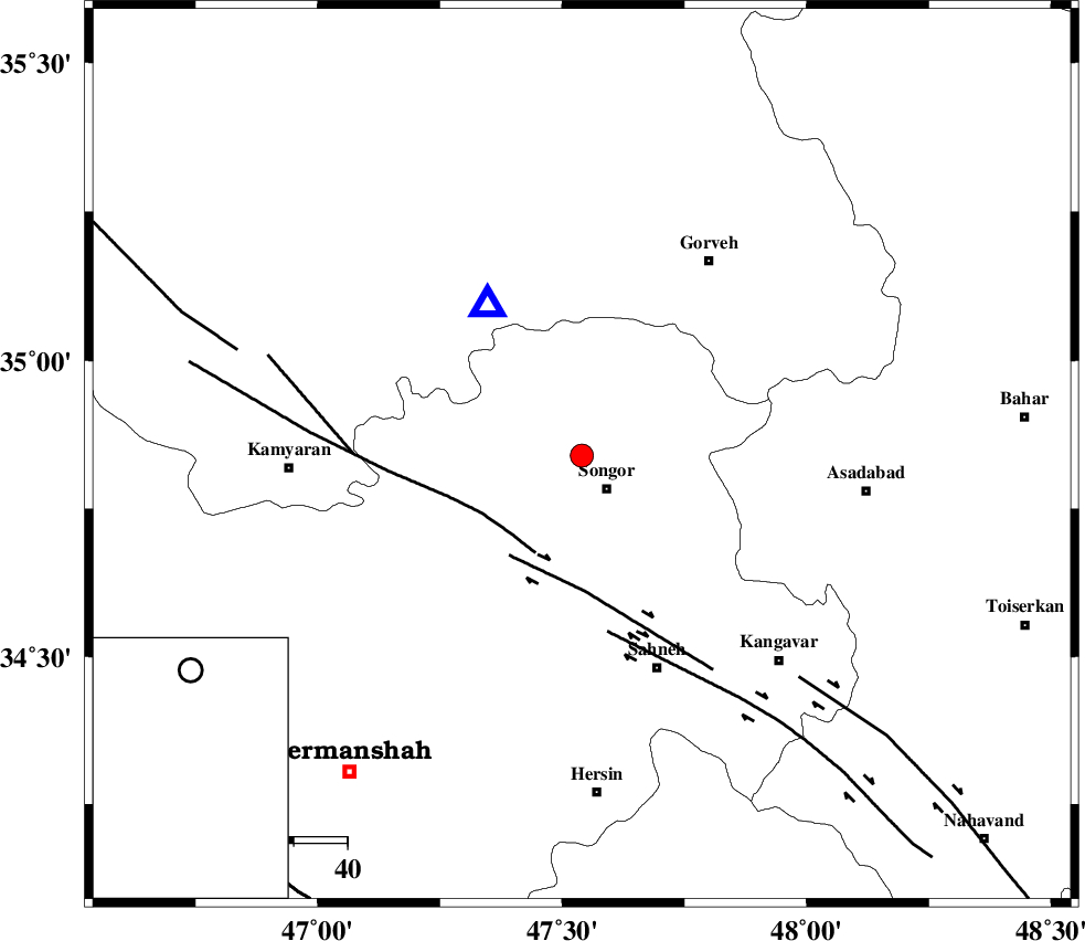
| Location | Lat:34.84 Lon: 47.54 |
| Region | Kermanshah Province, 8 km Sonqor |
Nearest Cities |
|
| 8 km North of Sonqor, Kermanshah Province | |
| 8 km of Qamam, Kermanshah Province | |
| 12 km North of Gaznahleh, Kermanshah Province | |
| 15 km East of Agah olia, Kermanshah Province | |
| 16 km West of Bavoleh, Kermanshah Province | |
| Depth | 14 km |
| Agency | |
Faults within 150 km: |
|
| SARTAKHT_F (Length: 78 km) , Distance to epicenter: 20 km | |
| DINEHVAR_F (Length: 46 km) , Distance to epicenter: 23 km | |
| SAHANEH_F (Length: 77 km) , Distance to epicenter: 33 km | |
| Number of Phases | 5 |
| RMS | 0 |
| Number of Stations | 4 |
| Error in Latitude | >7.2 km |
| Error in Longitude | 7.1 km |
| Error in Depth | 2.8 km |
Download waveform in seisan format
to download seisan software Click here
to access information about IIEES stations Click here
Amplitude | ||||||||
| UID | Agency | Station | Component | Amplitude | Period | Arrival Time | Proccessing Time | Signal Clip |
| 84086 | IIEES | SNGE | N | 2075.5 | 0.2 | 2012-06-09 19:20:35 | 2012-06-09 07:40:00 | n |
| 84087 | IIEES | SNGE | E | 1413.3 | 0.28 | 2012-06-09 19:20:35 | 2012-06-09 07:40:00 | n |
| 84088 | IIEES | KHMZ | N | 51.4 | 0.44 | 2012-06-09 19:21:35 | 2012-06-09 07:40:00 | n |
| 84089 | IIEES | GHVR | N | 24.5 | 0.72 | 2012-06-09 19:22:14 | 2012-06-09 07:40:00 | n |
Phase | ||||||||||||
| Agency | Station | Component | Phase Type | Phase Quality | First Motion | Observed Arrival Time | Time Residual | Loc. Flag | Input Weight | Distance | Azimuth | |
| IIEES | SNGE | Z | Pg | E | 2012-06-09 19:20:26 | -0.02 | y | 33.2 | 327 | |||
| IIEES | ASAO | Z | Pn | E | 2012-06-09 19:20:56 | 0.05 | y | 230 | 97 | |||
| IIEES | KHMZ | Z | Pn | E | 2012-06-09 19:20:59 | 0.02 | y | 254 | 118 | |||
| IIEES | KHMZ | N | Sg | E | 2012-06-09 19:21:32 | -0.04 | y | 254 | 118 | |||
| IIEES | GHVR | Z | Pn | E | 2012-06-09 19:21:10 | -0.01 | y | 342 | 96 | |||