
Magnitude |
3.1 |
| Date & Time (UTC) | 2012-06-12 11:17:25.4 |
| Date & Time (Local) | 1391/3/23 15:47:25.4 |
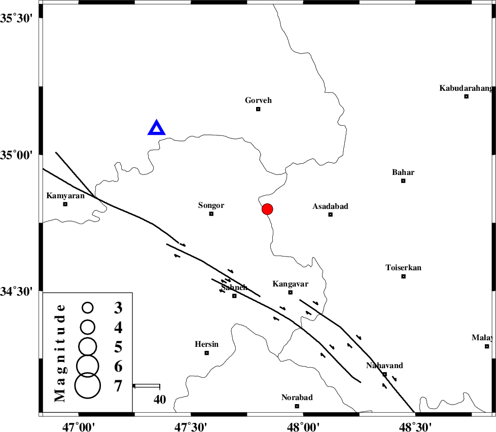
| Location | Lat:34.8 Lon: 47.84 |
| Region | Hamedan Province, 23 km East of Sonqor |
Nearest Cities |
|
| 6 km North of Ajin, Hamedan Province | |
| 8 km of Abbarik-e olia, Kermanshah Province | |
| 9 km of Abbarik-e sofla, Kermanshah Province | |
| 14 km North of Farsinaj, Kermanshah Province | |
| 15 km East of Bavoleh, Kermanshah Province | |
| Depth | 14 km |
| Agency | |
Faults within 150 km: |
|
| DINEHVAR_F (Length: 46 km) , Distance to epicenter: 34 km | |
| SAHANEH_F (Length: 77 km) , Distance to epicenter: 36 km | |
| SARTAKHT_F (Length: 78 km) , Distance to epicenter: 39 km | |
| Number of Phases | 6 |
| RMS | 0.2 |
| Number of Stations | 5 |
| Error in Latitude | >5.1 km |
| Error in Longitude | 4.9 km |
| Error in Depth | 5.4 km |
Download waveform in seisan format
to download seisan software Click here
to access information about IIEES stations Click here
Amplitude | ||||||||
| UID | Agency | Station | Component | Amplitude | Period | Arrival Time | Proccessing Time | Signal Clip |
| 84114 | IIEES | SNGE | N | 4432 | 0.68 | 2012-06-12 11:17:43 | 2012-06-12 11:47:00 | n |
| 84115 | IIEES | SNGE | E | 4096.2 | 0.16 | 2012-06-12 11:17:43 | 2012-06-12 11:47:00 | n |
| 84116 | IIEES | ASAO | E | 83.4 | 0.36 | 2012-06-12 11:18:25 | 2012-06-12 11:47:00 | n |
| 84117 | IIEES | KHMZ | E | 123.1 | 0.68 | 2012-06-12 11:18:33 | 2012-06-12 11:47:00 | n |
| 84118 | IIEES | KHMZ | N | 127.3 | 0.24 | 2012-06-12 11:18:34 | 2012-06-12 11:47:00 | n |
| 84119 | IIEES | GHVR | N | 33.9 | 0.72 | 2012-06-12 11:18:58 | 2012-06-12 11:47:00 | n |
| 84120 | IIEES | GHVR | E | 27.2 | 0.36 | 2012-06-12 11:19:00 | 2012-06-12 11:47:00 | n |
Phase | ||||||||||||
| Agency | Station | Component | Phase Type | Phase Quality | First Motion | Observed Arrival Time | Time Residual | Loc. Flag | Input Weight | Distance | Azimuth | |
| IIEES | SNGE | Z | Pg | E | 2012-06-12 11:17:35 | -0.08 | y | 55.4 | 306 | |||
| IIEES | ASAO | Z | Pn | E | 2012-06-12 11:17:58 | -0.24 | y | 202 | 97 | |||
| IIEES | ZNJK | Z | Pn | E | 2012-06-12 11:18:00 | 0.07 | y | 221 | 20 | |||
| IIEES | KHMZ | Z | Pn | E | 2012-06-12 11:18:01 | 0.25 | y | 228 | 120 | |||
| IIEES | KHMZ | N | Sg | E | 2012-06-12 11:18:30 | -0.09 | y | 228 | 120 | |||
| IIEES | GHVR | Z | Pn | E | 2012-06-12 11:18:12 | 0.1 | y | 314 | 96 | |||