
Magnitude |
3.8 |
| Date & Time (UTC) | 2012-08-30 20:15:33.9 |
| Date & Time (Local) | 1391/6/10 00:45:33.9 |
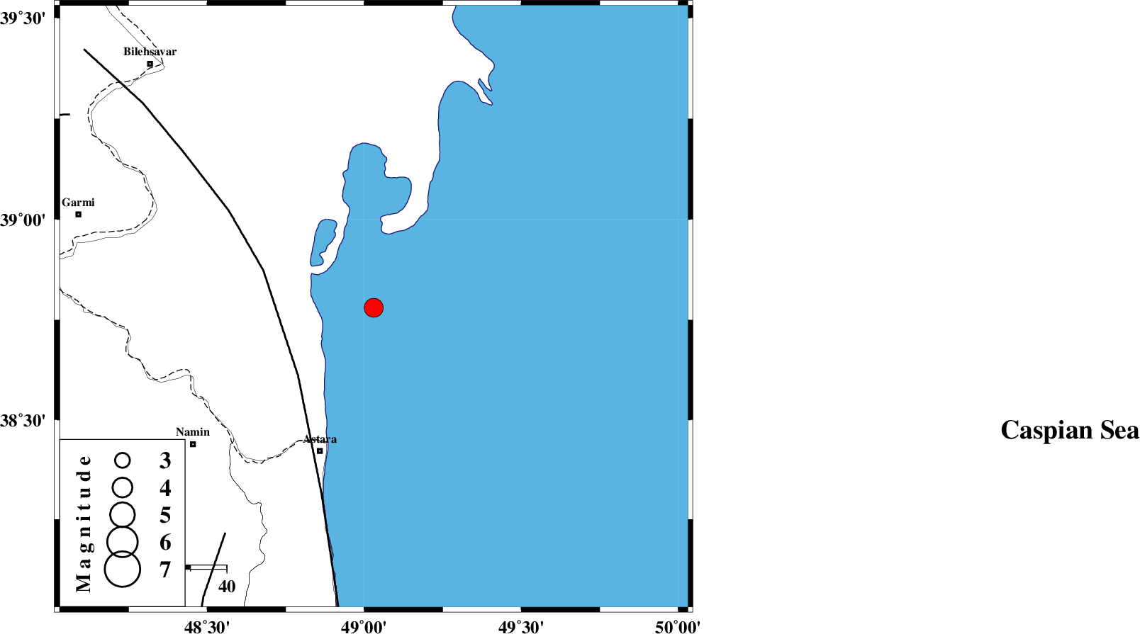
| Location | Lat:38.78 Lon: 49.03 |
| Region | Caspian Sea, 43 km North-East of Astara |
Nearest Cities |
|
| 43 km North East of Astara, Gilan Province | |
| 54 km North East of Londovil, Gilan Province | |
| 55 km North East of Kiladeh, Gilan Province | |
| 59 km North East of Anbaran, Ardebil Province | |
| 63 km North East of Namin, Ardebil Province | |
| Depth | 20 km |
| Agency | |
Faults within 150 km: |
|
| TALESH_F (Length: 258 km) , Distance to epicenter: 28 km | |
| SANGAVAR_F (Length: 61 km) , Distance to epicenter: 75 km | |
| BOZQUSH (Length: 70 km) , Distance to epicenter: 94 km | |
| Number of Phases | 7 |
| RMS | 0.1 |
| Number of Stations | 6 |
| Error in Latitude | >6.5 km |
| Error in Longitude | 5.6 km |
| Error in Depth | 6.9 km |
Download waveform in seisan format
to download seisan software Click here
to access information about IIEES stations Click here
Amplitude | ||||||||
| UID | Agency | Station | Component | Amplitude | Period | Arrival Time | Proccessing Time | Signal Clip |
| 85870 | IIEES | GRMI | E | 4239.2 | 0.36 | 2012-08-30 20:16:07 | 2012-08-30 08:29:00 | n |
| 85871 | IIEES | GRMI | N | 2534.3 | 0.32 | 2012-08-30 20:16:09 | 2012-08-30 08:29:00 | n |
Phase | ||||||||||||
| Agency | Station | Component | Phase Type | Phase Quality | First Motion | Observed Arrival Time | Time Residual | Loc. Flag | Input Weight | Distance | Azimuth | |
| IIEES | GRMI | Z | Pg | E | 2012-08-30 20:15:50 | 0.17 | y | 98.5 | 272 | |||
| IIEES | ZNJK | Z | Pn | E | 2012-08-30 20:16:10 | 0.09 | y | 236 | 187 | |||
| IIEES | THKV | Z | Pn | E | 2012-08-30 20:16:25 | -0.02 | y | 358 | 152 | |||
| IIEES | CHTH | Z | Pn | E | 2012-08-30 20:16:26 | -0.21 | y | 369 | 149 | |||
| IIEES | MAKU | Z | Pn | E | 2012-08-30 20:16:28 | 0.09 | y | 381 | 281 | |||
| IIEES | MAKU | N | Sg | E | 2012-08-30 20:17:17 | -0.22 | y | 381 | 281 | |||
| IIEES | DAMV | Z | Pn | E | 2012-08-30 20:16:35 | 0.04 | y | 437 | 142 | |||