
Magnitude |
2.2 |
| Date & Time (UTC) | 2012-10-23 20:49:06.5 |
| Date & Time (Local) | 1391/8/3 00:19:06.5 |
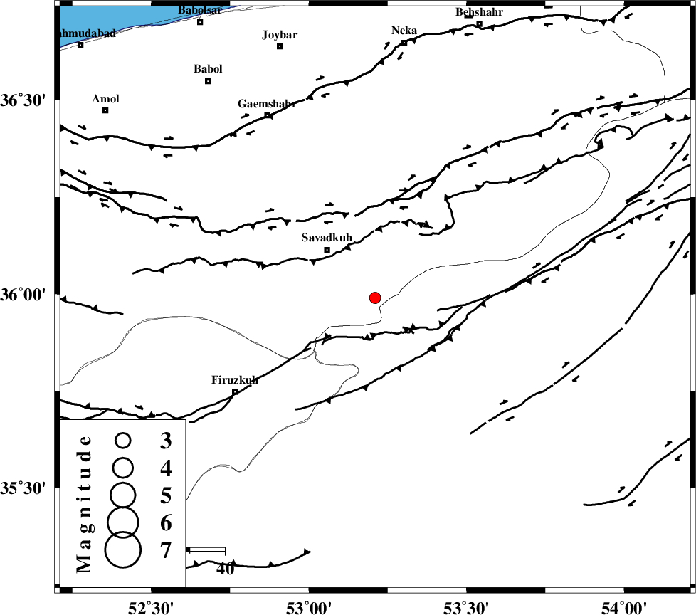
| Location | Lat:35.99 Lon: 53.21 |
| Region | Mazandaran Province, 19 km South-East of Pol-E-Sefid |
Nearest Cities |
|
| 9 km of Sangdeh, Mazandaran Province | |
| 12 km North of Chashem, Semnan Province | |
| 18 km South East of Shurmast-e peyrudbar, Mazandaran Province | |
| 19 km South East of Pol-E-Sefid, Mazandaran Province | |
| 24 km South East of Elahband, Mazandaran Province | |
| Depth | 37 km |
| Agency | |
Faults within 150 km: |
|
| N_ALBORZ_F (Length: 360 km) , Distance to epicenter: 24 km | |
| ATARI_F (Length: 185 km) , Distance to epicenter: 35 km | |
| KHAZAR_F (Length: 523 km) , Distance to epicenter: 57 km | |
| Number of Phases | 5 |
| RMS | 0.1 |
| Number of Stations | 3 |
| Error in Latitude | >3.6 km |
| Error in Longitude | 8.7 km |
| Error in Depth | 6.6 km |
Download waveform in seisan format
to download seisan software Click here
to access information about IIEES stations Click here
Amplitude | ||||||||
| UID | Agency | Station | Component | Amplitude | Period | Arrival Time | Proccessing Time | Signal Clip |
| 86721 | IIEES | GHVR | E | 14.3 | 0.36 | 2012-10-23 20:50:20 | 2012-10-24 04:05:00 | n |
| 86722 | IIEES | GHVR | N | 14.6 | 0.48 | 2012-10-23 20:50:20 | 2012-10-24 04:05:00 | n |
Phase | ||||||||||||
| Agency | Station | Component | Phase Type | Phase Quality | First Motion | Observed Arrival Time | Time Residual | Loc. Flag | Input Weight | Distance | Azimuth | |
| IIEES | DAMV | Z | Pg | E | 2012-10-23 20:49:26 | -0.09 | y | 119 | 251 | |||
| IIEES | DAMV | N | Sg | E | 2012-10-23 20:49:41 | -0.07 | y | 119 | 251 | |||
| IIEES | CHTH | Z | Pg | E | 2012-10-23 20:49:37 | 0.13 | y | 188 | 268 | |||
| IIEES | GHVR | Z | Pn | E | 2012-10-23 20:49:42 | -0.03 | y | 245 | 227 | |||
| IIEES | GHVR | E | Sg | E | 2012-10-23 20:50:14 | 0.07 | y | 245 | 227 | |||