
Magnitude |
2.8 |
| Date & Time (UTC) | 2012-11-18 16:08:20.9 |
| Date & Time (Local) | 1391/8/28 19:38:20.9 |
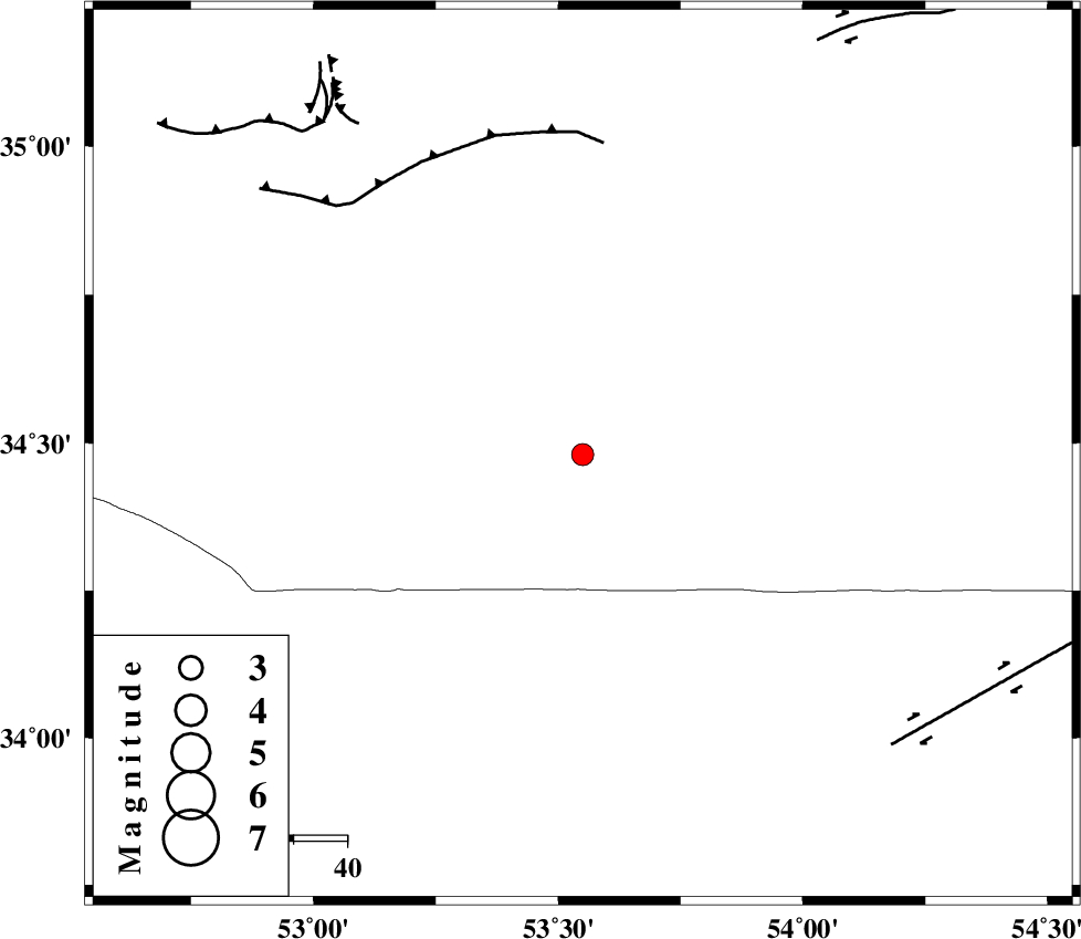
| Location | Lat:34.48 Lon: 53.55 |
| Region | Semnan Province, 121 km South-East of Semnan |
Nearest Cities |
|
| 93 km North West of Jondaq, Esfahan Province | |
| 94 km North East of Maedan, Esfahan Province | |
| 111 km South East of Lasjerd, Semnan Province | |
| 113 km South East of Sorkheh, Semnan Province | |
| 118 km South of Alae, Semnan Province | |
| Depth | 18 km |
| Agency | |
Faults within 150 km: |
|
| KUH_E_GUGERD_F (Length: 73 km) , Distance to epicenter: 59 km | |
| DORUNEH_F (Length: 713 km) , Distance to epicenter: 80 km | |
| KUH_E_GACHAB_F1 (Length: 53 km) , Distance to epicenter: 80 km | |
| Number of Phases | 6 |
| RMS | 0.1 |
| Number of Stations | 4 |
| Error in Latitude | >3.1 km |
| Error in Longitude | 4 km |
| Error in Depth | 4.6 km |
Download waveform in seisan format
to download seisan software Click here
to access information about IIEES stations Click here
Amplitude | ||||||||
| UID | Agency | Station | Component | Amplitude | Period | Arrival Time | Proccessing Time | Signal Clip |
| 87080 | IIEES | GHVR | E | 95.6 | 0.44 | 2012-11-18 16:09:22 | 2012-11-19 02:51:00 | n |
| 87081 | IIEES | GHVR | N | 51.4 | 0.72 | 2012-11-18 16:09:23 | 2012-11-19 02:51:00 | n |
| 87082 | IIEES | THKV | N | 44.1 | 0.36 | 2012-11-18 16:09:46 | 2012-11-19 02:51:00 | n |
| 87083 | IIEES | THKV | E | 43.7 | 0.56 | 2012-11-18 16:09:46 | 2012-11-19 02:51:00 | n |
Phase | ||||||||||||
| Agency | Station | Component | Phase Type | Phase Quality | First Motion | Observed Arrival Time | Time Residual | Loc. Flag | Input Weight | Distance | Azimuth | |
| IIEES | DAMV | Z | Pg | E | 2012-11-18 16:08:52 | 0.05 | y | 192 | 312 | |||
| IIEES | GHVR | Z | Pn | E | 2012-11-18 16:08:54 | 0.07 | y | 211 | 271 | |||
| IIEES | GHVR | N | Sg | E | 2012-11-18 16:09:20 | -0.03 | y | 211 | 271 | |||
| IIEES | CHTH | Z | Pn | E | 2012-11-18 16:09:02 | 0.02 | y | 271 | 306 | |||
| IIEES | THKV | Z | Pn | E | 2012-11-18 16:09:04 | -0.11 | y | 290 | 304 | |||
| IIEES | THKV | N | Sg | E | 2012-11-18 16:09:42 | 0 | y | 290 | 304 | |||